-(BOMBAY)MUMBAI TAXI 1850 TO 2001 Also BOMBAY MAPS and Names FROM 1600

press ctrl and + to see larger images
DEDICATED TO THE FIRST CITY-MUMBAI-[BOMBAY] ;OF INDIA.part-1
- History
reveals that the city consisted of seven islands namely Colaba, Mazagaon, Old Woman's Island, Wadala, Mahim, Parel, and Matunga-Sion. Although the sings of human life were found since the Stone Age,
History of South Asia
History of India Stone Age Before 3300 BCE - Mehrgarh Culture 7000–3300 BCE Indus Valley Civilization 3300–1700 BCE - Late Harappan Culture 1700–1300 BCE --Cemetery H culture 1900-1300 BCE --Ochre Coloured Pottery culture From 2000 BCE Swat culture 1600–500 BCE
[show]Iron Age 1200–180 BCE
[show]Middle kingdoms of India 1 CE–1279 CE
Delhi Sultanate 1206–1526 CE Deccan Sultanates 1490–1596 CE Mughal Empire 1526–1803 CE Durrani Empire 1747–1823 CE Vijayanagara Empire 1336–1646 CE Maratha Empire 1674–1818 CE
[show]Regional Empires 1100–1800 CE
Portuguese India 1505-1961 CE French India 1769–1954 CE Company rule in India 1757–1858 CE British Raj 1858–1947 CE Partition of India 1947 CE
History of India
| [show]Iron Age | 1200–180 BCE |
|---|
| [show]Middle kingdoms of India | 1 CE–1279 CE |
|---|
| [show]Regional Empires | 1100–1800 CE |
|---|
the people of fishermen community called koli dominated the island.

The people of Kolis community were the separate groups of tribes from Vindhya Plateau, Gujarat, and Konkan. During that period theregenerally three-four major tribes in the region.
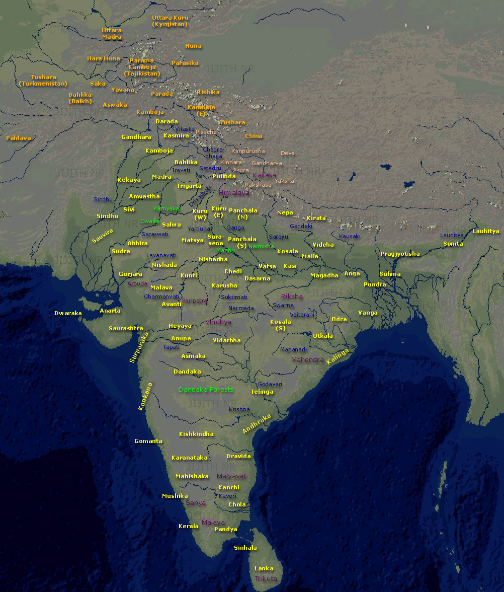 |
| Map of "Bharatvarsha" (Kingdom of India) during the time of Mahabharata and Ramayana. (Title and location names are in English |

Later the area of captured by the Mauryans in 250 B.C. Origin of Mumbai can be well understood by dividing the history of its evolution into different period.
The Period of Several Rulers: Mauryan Empire Ashoka captured the area from Kolis community and established his dominance during 350 B.C
 |
| Buddhist proselytism at the time of kingAshoka (260–218 BCE) |


.
Ancient history of sopara:-http://www.onevasai.com/History.aspx
 |
| ANCIENT PORT OF SOPARA (MODERN NALA SOPARA ) IN MAP [PRESS CTRL AND +TO SEE LARGER IMAGE] MAP OF 1OO A.D. BY PERIPLUS OF ROMAN EMPIRE |
 |
| Above is a Roman coin from the 3rd century A.D. (Probus, A.D. 276-282) which on the reverse depicts the pagan sun god driving a chariot drawn by four horses (Sol in Quadriga). The inscription reads SOLI INVICTO - The Invincible Sun.] |
 ANCIENT ROMAN COINS DISCOVERED IN INDIA INCLUDE,a period between 123 B.C. and 117 A.D. The denarii are from the periods of the Republic, Octavian ; Agustus BC 27 – AD 14, Tiberius AD 14 – 37, Claudius 41 – 54, and Nero 54 – 68. The aureii belong to the issue of Tiberius, Claudius, Nero, and Trajan
Gold Coin of AUGUSTUS CEASAR:-

Roman Gold Coin – Augustus Aureus. ceasar
Gold Coin of Julius Caesar:-
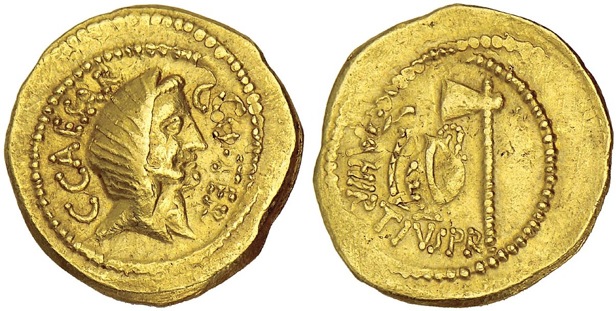
This gold coin reveals the veiled head of Julius Caesar on the front side with emblem "CAESAR COS TER
BECAUSE ROMAN EMPIRE TRADED WITH OTHER COUNTRIES; MOSTLY WITH GOLD COINS ,THERE ARE STILL CHANCES OF FINDING ROMAN GOLD COINS IN SOPARA / NALA SOPARA
 |
| roman ship used for trade with india |

one can see hundreds of ancient roman gold coins at -Koyikkal Palace, Thiruvananthapuram |
Location :Nedumangad, about 18 km from Thiruvananthapuram city on the way to the Ponmudi hill station and the Courtalam waterfalls, Thiruvananthapuram district, south Kerala. Attractions :Palace, folklore museum and numismatics museum. Visiting hours : 9:00 am to 5:00 pm on all days, except Mondays. |
 |
Nearly 374 Roman gold coins, each worth up to five hundred thousand rupees today, depicting Roman gods and goddesses like Venus, Hercules, Mars, Ceres, Genius, etc and rulers like Hardin (AD 117 - 138) are also among the collection.eveidence of ancient roman trade with india

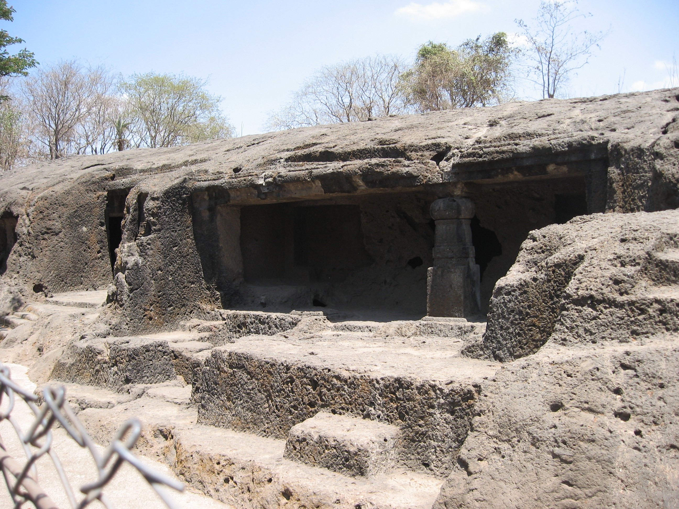
The Kanheri Caves
are a group of rock-cut monuments, located north of Borivali on the western outskirts of Mumbai, India, deep within the green forests of the Sanjay Gandhi National Park. It is 6 km from the National Park Main Gate & 7 km from Borivali Station. Tourists can go in after 7.30 a.m. Kanheri Caves are signs of Buddhist influence on art and culture in India. Kanheri comes from the Sanskrit word Krishnagiri generally meaning black in colour
These caves date from 1st century BCE to 10th century CE. In total in the basalt there have been carved 109 caves. Unlike the elegant splendor of Elephanta Caves nearby, the earlier cells are spartan and unadorned. Each cave has a stone plinth for a bed. A congregation hall with huge stone pillars contains the stupa, a Buddhist shrine. Farther up the hill are the remains of an ancient water system, canals and cisterns that collected and channeled the rainwater into huge tanks.[3]Once the caves became permanent monasteries, they began to be carved out of the rock with intricate reliefs of Buddha and the Bodhisattvas carved into the walls. Kanheri had become an important Buddhist settlement on the Konkan coast by the 3rd century A.D.
This area of was developed as the merging point of two religions namely Hinduism and Buddhism. Various manuscripts and works of fine arts related to Buddhism can be witnessed in the


 |
| the caves are inside national park named agter sanjay gandhi |
 |
| inside sanjay gandhi national park there is an enclosed space called lion safari park |
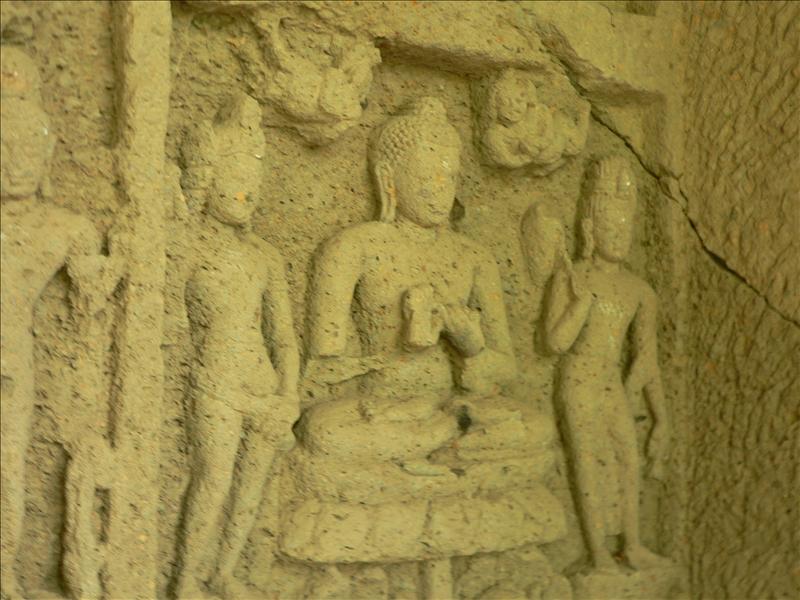
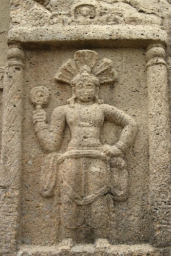 | |
A depiction of a framed male alongside the entrance to one of the caves.  sanjay gandhi national park -the only national park inside a major city any where in the world  Toy train at Sanjay Gandhi Biological park  
|

This prayer room at Kanheri, Mumbai, was carved out of one single rock in 1st century B.C.! Kanheri Caves had become an important Buddhist settlement on the Konkan coast by the 3rd century A.D.
and mahakali Caves
 |
BELOW -ELEPHANTA CAVES
 |
Except the Buddistic relics found at Elephanta, the Mauryas do not appear to have left, any visible traces of their supremacy, over the island of Bombay Garcia da Orta^ who visited it in 1534 A.D. "There is a hill on it, and at the top of this hill, an underground dwelling, hewn out of a living rock. This dwelling is as large as a monastery, and has open courts, and cisterns of very good water. On the walls around, there are very large sculptured images of elephants, lions, tigers, and of many human figures well represented. It is a thing worth seeing," |


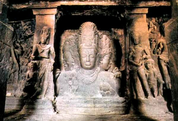


boat to Elephanta island from gate way of india
of that century.
With the decline of Mauryas the area came under the control of Satavahanas,:-


who had friendly relations with the kingdom of Rome and developed the port of Sopara (recognized as Nala Sopara later) as the major centre of Trade with Rome. According to the renowned Greek Geographer of the then period Ptolemy the group of islands was called as Heptanesia at that time.
,
perhaps on account of a decline in central power
With the decline of Satavahanas, the area felt under the control of rulers of Abhiras [AHIR]

and Vakatakas who originated from the areas of Western Maharashtra and Vidharbha respectively.
Later in the fifth century the area came under the control of Kalachuris of Central India,. It was during their rule that the
Jogeshwari Caves were constructed.
Tthe Chalukyas of Karnataka under Pulakesi II invaded the area

and abolished the control of Mauryas from the area.
 ABOVE :-Around 625-26 AD , Chalukya King Pulakesin II (AD 610-42) exchanged envoys with Sassanian King Khusrau II (AD 596- 626). The same has been depicted in Ajantha Cave I
Later during 749-750 A.D. Dantidurga of
Rashtrakuta Dynasty from Karanataka captured the island
and established his dominance in the area.

 Shiva sculpture at Ellora Caves.-MADE DURING RASHTRAKUTA KINGS REIGN
With the decline of Mauryas the area came under the control of Satavahanas,:-

The Edicts of Ashoka mention the Sātavāhanas as feudatories of Emperor Ashoka. Fragment of the 6th Pillar Edicts of Ashoka (238 BCE), in Brahmi, sandstone. British Museum.The Satavahanas declared independence some time after the death of Ashoka (232 BCE), as the Maurya Empire began to weaken.

Indian ship on lead coin of Vasisthiputra Sri Pulamavi, testimony to the seafaring and trading capabilities of the Satavahanas during the 1st–2nd century CE.
| Vasisthiputra Sri Pulamavi | |
|---|---|
| Satavahana | |
 | |
| Silver coin of Vasisthiputra Sri Pulamavi. British Museum. | |
| Reign | 78–114 CE |
| |||
 | |||
who had friendly relations with the kingdom of Rome and developed the port of Sopara (recognized as Nala Sopara later) as the major centre of Trade with Rome. According to the renowned Greek Geographer of the then period Ptolemy the group of islands was called as Heptanesia at that time.
According to the Nasik inscription made by his[Gautamiputra (Sri Yagna) Sātakarni (also known as Shalivahan] mother Gautami Balasri, he is the one......who crushed down the pride and conceit of the Kshatriyas (the native Indian princes, the Rajputs of Rajputana, Gujarat and Central India); who destroyed the Shakas (Western Kshatrapas), Yavanas (Indo-Greeks)
and Pahlavas (Indo-Parthians),... who rooted the Khakharata family (The Kshaharata family of Nahapana); who restored the glory of the Satavahana race[12]Gautamiputra Satakarni may also have defeated Shaka king Vikramaditya in 78 BCE and started the calendar known as Shalivahana era or Shaka era, which is followed by the Gujarati, Marathi, Kannadiga and Telugu people and is the Indian National Calendar.
the dynasty was soon extinguished following the rise of its feudatories
,
perhaps on account of a decline in central power
Several dynasties divided the lands of the kingdom among themselves. Among them were:
- Western Satraps in the northwestern part of the kingdom.
- Andhra Ikshvakus (or Srīparvatiyas) in the Krishna-Guntur region. (r. 220–320 CE).
- Abhiras in the western part of the kingdom. They were ultimately to succeed the Sātavāhanas in their capital Pratishthānapura
- .[MODERN DAY PAITHAN TOWN OF MAHARASHTRA STATE]http://en.wikipedia.org/wiki/Paithan
- .http://en.wikipedia.org/wiki/Paithan
- Chutus of Banavasi in North Karnataka
- Kadambas of Banavasi in North Karnataka.
- Pallavas of Kanchipuram, of whom the first ruler was Simhavarman I (r. 275–300 CE).
With the decline of Satavahanas, the area felt under the control of rulers of Abhiras [AHIR]
Ahir Kings:-
- Ra Mandalika (Ruler of Somnath)
- Ra Graharipu
- Rao Tula Ram
- King Poru
- Rudramurti Ahir
- Madhuriputra (mingled with rajputs)
- Samudragupta]
- Ishwarsena (Western Deccan)
- Virsen (Jalgaon)

Royal emblem of Kalachurya. Kalachuri belonged to Abhira Dynasty
{Ahirs or Ahers of MaharashtraIn Marubhumi (Marwar), Saurashtra and Maharashtra they served the local rulers and established their own rule. Ishwarsena, a great Ahir general, became master of Western Deccan in place of the famous Satava-hanas. He took the title of Rajan and an era was named after him. His descendants continued to rule for nine generations. There is a significant concentration of [Aher]s in Northern Maharashtra. They are very influential in politics, administration. They are all Kshatriyas with classification as 96 Kuli Marathas since the establishment of Hindavi Swaraj byChhatrapati Shivaji.}
and Vakatakas who originated from the areas of Western Maharashtra and Vidharbha respectively.
Rulers of the Vakataka dynasty
- Vindhyasakti (250-270)
- Pravarasena I (270- 330)
http://en.wikipedia.org/wiki/Vakataka_dynasty
The Pravarapura-Nandivardhana branch
- Rudrasena I (330 - 355)
- Prithvisena I (355 - 380)
- Rudrasena II (380- 385)
- Divakarasena (385- 400)
- Prabhavatigupta (fem.), Regent (385- 405)
- Damodarasena (Pravarasena II) (400- 440)
- Narendrasena (440- 460)
- Prithvishena II (460- 480)
Later in the fifth century the area came under the control of Kalachuris of Central India,. It was during their rule that the
Jogeshwari Caves were constructed.
| Jogeshwari Caves | |
|---|---|
 |
| Middle kingdoms of India | ||||||||||||
| Timeline: | Northwestern India | Northern India | Southern India | |||||||||
|---|---|---|---|---|---|---|---|---|---|---|---|---|
6th century BCE 5th century BCE 4th century BCE 3rd century BCE 2nd century BCE 1st century BCE 1st century CE 2nd century 3rd century 4th century 5th century 6th century 7th century 8th century 9th century 10th century 11th century |
| |||||||||||
Cosmas Indicopleustes (literally "who sailed to India") of Alexandria was a Greek merchantand later monk probably of Nestorian tendencies.He was a 6th century traveller, who made several voyages to India during the reign of emperor Justinian. His Topografia Christiana (Christian Topography) contained some of the earliest and most famous world mapsThe origin of world known Elephanta Caves dates back to the same period.Establishment of Nestorian Church on the islands marked the arrival of Christians in the country.
Tthe Chalukyas of Karnataka under Pulakesi II invaded the area

Chalukya Territories during Pulakesin II c. 640 C.E
and abolished the control of Mauryas from the area.
Pulikesin II exchanges envoys with Sassanaid Khusro II[of Persia-modern day Iran]

Later during 749-750 A.D. Dantidurga of
Rashtrakuta Dynasty from Karanataka captured the island
and established his dominance in the area.
Rashtrakutas of Manyakheta | ||||
| Empire (Subordinate to Badami Chalukyas until 753) | ||||
| ||||
 Extent of Rashtrakuta Empire, 800 CE, 915 CE | ||||

| Rashtrakuta Kings (753-982) | |
| Dantidurga | (735 - 756) |
| Krishna I | (756 - 774) |
| Govinda II | (774 - 780) |
| Dhruva Dharavarsha | (780 - 793) |
| Govinda III | (793 - 814) |
| Amoghavarsha I | (814 - 878) |
| Krishna II | (878 - 914) |
| Indra III | (914 -929) |
| Amoghavarsha II | (929 - 930) |
| Govinda IV | (930 – 936) |
| Amoghavarsha III | (936 – 939) |
| Krishna III | (939 – 967) |
| Khottiga Amoghavarsha | (967 – 972) |
| Karka II | (972 – 973) |
| Indra IV | (973 – 982) |
| Tailapa II (Western Chalukyas) | (973- |

With the passing time the area came under the control of the rulers of Silhara dynasty of Konkan during 810 to 1260.The Hindu
Silhara dynasty ruled the region
The genealogy of this branch of the Shilaharas ruling over North Konkan may be stated as follows :—

They were split into three branches; one branch ruled North Konkan, the second South Konkan (between 765 to 1029), while the third ruled what is now known as modern districts of Satara, Kolhapur and Belgaon between 940 to 1215 after which they were overwhelmed by the Chalukya.The dynasty originally began as vassals of the Rashtrakuta dynasty which ruled the Deccan plateau between the 8th and 10th centuries.
Govinda II, a Rashtrakuta king, conferred the kingdom of North Konkan (modern districts of Thane, Mumbai and Raigad) on Kapardin (Sanskrit: Wearing the kaparda, a peculiar braid or knot of hair - also a term for Hindu god Shiva) I, founder of the Northern Silhara family, around 800.
Since then North Konkan came to be known as Kapardi-dvipa or Kavadidvipa. The capital
of this branch was Puri, now known as
Rajapur in the Raigad District

Govinda II, a Rashtrakuta king, conferred the kingdom of North Konkan (modern districts of Thane, Mumbai and Raigad) on Kapardin (Sanskrit: Wearing the kaparda, a peculiar braid or knot of hair - also a term for Hindu god Shiva) I, founder of the Northern Silhara family, around 800.
of this branch was Puri, now known as
Rajapur in the Raigad District
The Silaharas of the Northern Konkan carried the
Suvarna Garuda, t.e., the figure of a golden eagle, on
their royal standard 
A number of ancient monuments in Mumbai pay tribute to this dynasty's prowess: The Walkeshwar Temple


and the Banganga Tank were built during the reign of Chittaraja, a king of this dynasty

The Ambarnath temple, also near Mumbai, was also built by Chittaraja in 1060
 |
| Ambernath Shiva Temple Picture |
The reign of the Silhara Dynasty ended in 1343,
when the regions in and around Mumbai were captured by the rulers of erstwhile princely states of Gujarat.under
Raja Bhimdev
| सोलंकी Solanki Samrajya Solanki Empire | ||||
| ||||
| Capital | Patan | |||
| Language(s) | Gujarati | |||
| Religion | Hinduism Jainism | |||
| Government | Monarchy | |||
| King | ||||
| - 942/960-995/997 | Mulraj I | |||
| - 1143–1173 | Kumarpal | |||
| - 1242–1244 | Tribuvanpal | |||
| Historical era | Classical India | |||
| - Established | CE 942 | |||
| - Disestablished | CE 1244 | |||
The last king Samantsinh Chawra did not have any children so
he adopted his nephew Mulraj Solanki who overthrew him in
942 and set up what came to be known as the Solanki dynasty
SOLANKI DYNASTY:-
            1.MULRAJA I
                   960/995 or 942/997
            2.CHAMUNDARAJA
                   |
             3.VALLBARAJA
                   |
           4.DURLABHARAJA ----- Unknown
                1009/1021         |
                              5.BHIMA DEV I
                                  | 1021/1063+
         --------------------------
         |                        |
7.SIDHRAJA JAISINH        6.KARNA I [Karan Dev I]
                                  | 1063/1093
     1093/1143+                   |
                                  |
                            8.KUMARAPALA ----- Unknown (Brother)
                                   1143/1173      |
                                             9.AJAVAPALA
                                                       |
                                 --------------------------------
                                 |                              |
                         11.BHIMA DEV II (killed nephew)     Unknown (die while Ajavpal was alive)
                                | died 1242                     |
                         12.TRIBUVANPAL                        10.MULRAJA II
                                   1242/1244
With the advent of Bhimdev and his followers begins the history of the growth and colonisation of Bombay. The island of Mahim upon which he settled, had, previous to his arrival, been known as ' Mewale' or 'Baradbet' (the desert island); one of a group of isles, sparsely peopled by families of Koli fishermen and other low castes, overgrown with babul trees, and dowered with a fine temple of Walkeshwar and a shrine of the ancient goddess Mumbadevi. Here Bhimdev stayed and built a fair city of temples and palaces, for himself and his followers, which he called 'Mahikavati' (Mahim)
During the late 13th century King Bhimdev of Yadav dynasty established his control and constructed various temples in he area.
|

Raja Bhimdev-2:-
was a 13th century king . He may have come from Anahilwada-Patan, Gujarat
Patan, an ancient fortified town, was founded in 745 AD by Vanraj Chavda, the most prominent king of the Chavda Kingdom. He named the city Anhilpur Patan or "Anhilwad Patan" after his close friend and Prime Minister Anhil shepherd. It is variously referred to in Sanskrit literature as Anahilpatak, Anahipattan, Anahilpur, Anahilvad Pattan
Qutb-ud-din Aybak sacked the city between 1200 and 1210, and it was destroyed by the Alladin Khilji in 1298.
Qutb-ud-din Aybak sacked the city between 1200 and 1210, and it was destroyed by the Alladin Khilji in 1298.
| Patan | |
| — city — | |


Edwardes in his book The Rise of Bombay
has given the following account of Bimba :—
" Now the story of events subsequent to the victory of Alla-ud-din forms a most important portion of the history of our island. It is universally acknowledged that, after the defeat of Ramdev, a certain Bimba or Bhima Raja established himself as ruler of the North Konkan, and colonised the islands of Bombay : and our first duty is to try and discover the identity of a man who was the pioneer in the task of raising Bombay above the level of a mere fishing hamlet.
An old poem, the Bimbakhyan,
relates that king Bimbadev came to the Konkan by way of Anahilvada in the shaka year 1216, that is 1294 A.D., and halted upon the island of Mahim, which he found almost uninhabited. So charmed was he with the scenery of the island, that he caused a royal palace to be built there, and also houses for the accommodation of the royal guests and others, who had accompanied him to the Konkan through fear of the Muslim invaders of Devagiri and Anahilwada: with him there came from Paithan, Champaner and other places, 9 families of Yajurvedi Brahmins of the Madhyandin Shakha and 66 other families, that is to say, 27 Kulas or families of the Somavanshis, 12 of Suryavanshis, 9 of Sheshavanshis; 5 of Panchal, 7 of Kunbis or Agris, 1 family of Dasa Lad, 1 of Visa Lad, 1 of Moda, 1 of Dasa Moda and 1 of Visa Moda.
"Now some authorities, notably the late Dr. Gersonda Cunha, believe that the Bimbadev or Bimb Raja here mentioned was identical with one of the Bhima Rajas of the Chalukya (Solanki) dynasty, which reigned at Anahilvada in Gujarat; and Dr. da Cunha further observes in his Origin of Bombay that Bhim Raja of Gujarat after his defeat by Mahomed of Gazni at Somnathin the year A.D. 1024, " fled from his country, and, to make up for the loss in the north,marched with his colony from Patan into the south and settled at Mahim.
"But it is a well-known historical fact that, immediately after Mahomed of Gazni had departed with his army, Bhima Raja[Bimb dev-1] returned to his country of Anahilvada, and in virtue of his devotion to Somnath of Prabhasa, caused the temple of Somnath to be built of stones in lieu of the former wooden temple which Mahomed had destroyed, that he later sent an army against and subdued the chief of Abu, and that he reigned at Anahilvada till his death in the year A.D. 1064.
"Again, the authors of Prabandha Chintamani and Dvyashraya Jain chronicles of Gujarat have recorded the most minute details of the reigns of the Chalukya kings of Anahilvada and had the conquest and colonisation of Mahim or the Konkan by this Bhima Raja and his Gujarat followers actually taken place
,
It is indisputable that the Shilahara monarchs ruled these lands until A.D. 1260, and then yielded place, to the Yadavas of Devgiri.
according to old Marathi and Persian records, now in the possession of the family of the late Sirdesai of Malad, seized the North Konkan, made Mahi or Mahim (Bombay) the capital of his kingdom, and divided the country into 15 mahals or districts, comprising 1,624 villages ? "(S. M. Edwardes, Rise of Bombay : A Retrospect (Bombay, 1902), pp. 22-25)
Bimbashah, hearing of thedefeat of his father Ramadev of Devagiri by Alla-ud-din, fled with the Rajguru Purushottam Pant Kavle and eleven umraos by the shore of the sea, and took possession of the fort of Parner, and of Bardi, Sanjan, Daman, Shirgaon and other places. He thus obtained all the territory from Parner to Astagar. He came unto Mahi (Mahim in Bombay), and divided the country into 12 parts, giving the province of Malad and some villages from the province of Pahad unto the Rajguru Kavle. The Bimbakhyan also records that the king gave the village of Pahad to the Raj-purohit Kavle, and the village of Paspavli to the Senadhipati and Kulguru Gangadhar Pant Nayak.
" Lastly, a Danapatra, or grant of the rights of Sirdesai and Sirdeshpande, made by king Bimbdev to his Rajguru Purushottam Kavle in the Shaka year 1221 (A.D. 1299), shows that the province of the Konkan contained 14 parganas or districts, and 2 kashas or sub-districts, and that the island of Mahim (Bombay) was called a pargana containing 7 hamlets.
It further states that 'In the month of Magh Shaka 1220 (A.D. 1298) Maharajadhiraja Bimbshah purchased from Changunabai, widow of Govind Mitkari, the watan of Sirdesai and Sirdeshpande in the provinces of Malad, etc., for 24,000rayats, and after keeping it in his possession for one year and three months, presented it as a religious offering to his spiritual guide Purushottam Kavle of the Bharadvaja Gotra, on the occasion of a Solar Eclipse in the dark half of the monthVaishakh in the Shaka year 1221 (A.D. 1299), and in the presence of $n assembly consisting of the prime minister Madhavrao Shrinivas, Chitnavis Chandraban Prabhu, Patangrao Nyayadhish and others, merchants, mahajans and jamindars." (S. M. Edwardes, Rise of Bombay : A Retrospect (Bombay, 1902), pp. 25-27).
It further states that 'In the month of Magh Shaka 1220 (A.D. 1298) Maharajadhiraja Bimbshah purchased from Changunabai, widow of Govind Mitkari, the watan of Sirdesai and Sirdeshpande in the provinces of Malad, etc., for 24,000rayats, and after keeping it in his possession for one year and three months, presented it as a religious offering to his spiritual guide Purushottam Kavle of the Bharadvaja Gotra, on the occasion of a Solar Eclipse in the dark half of the monthVaishakh in the Shaka year 1221 (A.D. 1299), and in the presence of $n assembly consisting of the prime minister Madhavrao Shrinivas, Chitnavis Chandraban Prabhu, Patangrao Nyayadhish and others, merchants, mahajans and jamindars." (S. M. Edwardes, Rise of Bombay : A Retrospect (Bombay, 1902), pp. 25-27).
The above evidence leads us to the conclusion that King Bhimdev, who died in the Shaka year 1225 (A.D. 1303), was succeeded by his son Pratapbimba or Pratapshah, was none other than Bhima Raja, the second son of king Ramdev of Devagiri. It was a common custom among Hindu princes whenever they found their lives or Kingdom in danger, to send to a place of safety a scion of the royal house, in order that the vansha or royal line might not become extinct ; and it seems to us probable that Ramdev, seeing his other son Shankar overpowered, and being surrounded by the advancing army of Ala-ud-din, took the precaution of despatching his second son Bhimdev to the Konkan, which had upto that date been free from Muslim attack, and was indeed in the guardianship of Krishna, a viceroy of his own choosing.
With the advent of Bhimdev and his followers begins the history of the growth and colonisation of Bombay.
The island of Mahim upon which he settled, had, previous to his arrival, been known as ' Mewale' or 'Baradbet' (the desert island); one of a group of isles, sparsely peopled by families of Koli fishermen
The island of Mahim upon which he settled, had, previous to his arrival, been known as ' Mewale' or 'Baradbet' (the desert island); one of a group of isles, sparsely peopled by families of Koli fishermen
Bimb the misty king was the indisputable founder of Bombay;
and raised Bombay to the position of a capital under the title of Mahikavati or Mahim.
and raised Bombay to the position of a capital under the title of Mahikavati or Mahim.
These information from:-
in the village of Naigaon, which lies between Vadala and Parel, a spot known to the villagers as 'Bhima Raja's Wadi'. At present the place is occupied by the Arshe Mahal or Mirror Palace of Jivanlal Maharaj; but local tradition, prevalent among the descendants of Bhim Raja's followers, declares that here stood of old one of the two palaces, built by that king,
the principal seat of nyaya or justice. The second palace was at Kheda, Lower Mahim
In the Shaka year 1225 (A.D. 1303) King Bhimdev died, and was succeeded by his son Pratapbimba, as he is sometimes called. Nothing of importance is known or recorded of him, save that
he built another capital city at Marol in Salsette, which he named Pratappur. The name of the city still lives as Pardapur or Parjapur, a deserted village near the centre of Salsette.
"In the year 1318 A.D., after the reduction of Devagiri and the defeat and death of Harpaldev, son-in-law of the Yadava monarch Ramdev, Mubarak, the emperor of Delhi, ordered his garrisons to be extended to the sea, and occupied Mahim and Salsette.
But Muhammedan supremacy was probably not firmly established till later; for old Marathi records show that Pratapshah reigned for 28 years, that is, till A.D. 1331, when he was slain, and his kingdom usurped, by his brother-in-law Nagardev, the chief of Cheul.
"Nagardev reigned for 17 years, that is, till the year 1348, when his dominions passed into the hands of the Muslim rulers of Gujarat; and thus came to an end the sovereignty of old Hindu kings over the island of Bombay and its dependencies." ( S. M. Edwardes, Rise of Bombay : A Retrospect (Bombay, 1902), pp. 33-36.)
"Those well-known names 'Thakurvadi' and 'Bhoivadi' also date from this epoch; for the Thakurs, Bhoirs, and Gawands were three recognised divisions among the lower classes of Bhimdev's retinue. The Thakurs were the petty officers of his army; the Bhoirs or Bhois were his palanquin bearers; and both have left the legacy of their name of the locality in which they made their home.
| Seuna dynasty | |
| Official languages | Kannada, Marathi,Sanskrit |
| Capital | Devagiri |
| Government | Monarchy |
| Preceding state | Western Chalukyas |
| Succeeding state | Deccan Sultanates |

Raja Bhimdev was a 13th century king;and He is said to have built a palace and a court of justice in Prabhadevi and had his capital
Babulnath is an ancient Shiva temple in Mumbai, India. Shiva in the form of the Lord of the Babul tree is the main deity in this temple. The faithful climb up to the temple and obtain Darshan of the shivling and obtain blessings of the Lord. It is also possible to take an elevator up to the temple. The Bombay International School lies opposite the temple.
Babulnath Temple Shiva Linga and Idols were originally consecrated in the 12th century by the then Hindu king of the region. Over a period of time the temple was buried and lost over a period of time. The idols were re discovered (unearthed) in 1700 to 1780 time frame. The first temple was built in the 1780 year.
When rediscovered, 5 original idols were dug out. That of the main Shiva Linga, Ganesh, Hanuman, Parvati and one more. Out of this the first four are in the temple.
The deity in this temple is named after the Babul trees

which were the main components of a forest covering the low-lying areas of this island.

which were the main components of a forest covering the low-lying areas of this island.
During his reign he is supposed to have brought:-
Amongst Pathare Prabhu families 12 families belong to solar line and 17 to lunar line.According to the records[9] Pathare Prabhu rulers were at Ayodhya and from there they went to Paithan and from there to Konkan. These records show that the people of this community eventually spread across the country.after the Turkic attacked and subdued the Pratihara rulers around the 12th and 13th centuries AD, some families migrated toMumbai and other regions in Maharashtra via Prabhas Pattan in Gujarat. Gentlmen from this community of Pathare Prabhu also held important position in the court of Yadava kings of Deogiri. After fall of Yadava dynasty at the hands of Alauddin Khilji; members of Pathare Prabhu community decided to return under the stewardship of King Bimba to Mumbai region along with their Yajurvedi Brahmins where other families had already settled
Palshis, Pachkalshis,
The Prabhus settled in the proximity of their temple of Prabhadevi, while the Somavanshis or Panchakalshis had their colony at' Parel. Here, they built three temples under the pa- tronage of the Raja, two for their family deities,* Wageshwari and Chandika, and the third for Mahadev, and called it Parali Vaijanath Mahadev. It is said that the ling of this Mahadev is Swayambhu or inar-tificial, and, therefore, it was considered of equal im- portance in sanctity, as the celebrated ling of Vaijanath at Parali, in the Dekkan. And as the Mahadev was called Vaijanath Mahadev, the village came to be called Parali or Paral .[modern name -parel]The temple of this Mahadev is, at present, situated in the middle of the Parel village, and is said to be on the same spot, where the old temple stoodBhandaris,:-
Bhandari (Devanagari:भंडारी) caste is among the sea-faring warrior castes (Rajput) of ancient and medieval India. They migrated southward from Rajputana in early 1100 and subsequently spread over different parts of India. Along with Maharashtra, Goa, parts of Karnataka likeKarwar; they can be found in significant numbers in Nepal, Rajasthan, parts of Central India, Gujarat and Andhra Pradesh, Kumaon andGarhwal of Uttarakhand, India.Sheshwanshi Bhandaris arrived with King Bhimdev, who established his base in Mumbai in 13th Century
Vadvals,
Vadvals,
Bhois, :-in Maharastra, the Bhois were the palanquin bearers or doli carriers. There are altogether 22 sub-groups.the word ‘Bhoi’ is from the word bhovi meaning the leader or headman of group of vaddars community speaks vaddar language originated from Rayala seema meaning the land of rocks.
Agris:-The tradition common among them is that they originally dwelt at Mungi Paithan and were transported to the Konkan by Bimbaraja.The name Agri comes from Agar, a salt-pan
 |
A studio portrait of a Kathiawar Rajput gentleman posed with a hookah, from the Archaeological Survey of India Collections. This was taken by Hurrichund Chintamon and shown in the Paris Exhibition of 1867 |
 |
| Studio portrait of the Nimbalkar of Satara (a Maratha), taken at Mumbai by Hurrichund Chintamon c. 1867, from the Archaeological Survey of India Collections. This photograph was exhibited at the Paris Exhibition of 1867. A Maratha was a member of the princely and military class of the former Hindu kingdom of Maharashtra in central India (now the modern state of Maharashtra). |
 |
Portrait of three Parsees and a Parbhu, taken by Hurrichund Chintamon, c. 1867. As Europeans came into contact with other peoples there was an urge to document different races, customs, costumes and occupations.. |
 |
| full-length portrait of two women and a child of the Vinchoorka family, Deccani Brahmins, taken by an unknown photographer at Mumbai, c. 1867. This photograph is from the Archaeological Survey of India Collections; one of a series of ethnographical photographs commissioned by the Government of India in the late 19th century to gather information about the people |

Parsees came later to Bombay when second english governor -Gerald Aungier requested 'all from every where in india ' to come and settle in bombay-
The Mughal Period:
The Muslim ruler Mubarak Khan of Khaliji dynasty
| Alauddin Ghilai (Gharzai),(Khilji), aka Ali Gurshap | |
|---|---|
| Sultan of the Khilji dynasty | |

of Gujaratcaptured the area from the Hindu rulers and established his dominance on the islands.
He appointed Maliq-us-Sharq as the governor of Mahim
and entrusted him the authority to make survey of existing rules in the islands and also amended the existing revenue system of the island. However, during the early
15th century the Bhandaris captured the island from the Mughal rulers and controlled the area for eight years.
After which the area was recaptured by Rai Qutb of Gujarat Sultanate.
Rai Qutb was an officer of the Gujarat Sultanate who had conquered Mahim, a village in Mumbai, India. During the early 15th century, theBhandaris seized the island of Mahim from the Sultanate and ruled it for eight years. It was reconquered by Rai Qutb of the Gujarat Sultanate. He died in 1429-1430
It is related that the daughter of the Rai of Mahim was given in marriage to Prince Fateh Khan, the son of Ahmad Shah of Gujarat.Ahmed Shah of Gujarat was a sultan of Gujarat's ruling Muzaffarid dynasty from 1411 until his death in 1442. Today, he is famously known as Ahmed Shah Badshah of Ahmedabad.
{THIS WAS THE FIRST OCCASION WHEN BOMBAY(MAHIM) WAS ASSOCIATED WITH A MARRIAGE
LATER THE PORTUGUESE ,WHEN THEY GAVE BOMBAY(FORT AND SURROUNDING AREA) AS DOWRY OF THEIR PRINCESS; TO CHARLES 2 OF ENGLAND}in 1661, Catherine of Braganza


He founded Ahmedabad city and established it as the capital of the Gujarat Sultanate. The Ahmedabad city real name is Ahmed Aabad. The city Ahmedabad is named after its founder, Ahmad Shah.



After the death of Rai Qutb the area came
under the control of Ahmad Shah I Wali of Bahmani Sultanate.

Sultan Ahmed Shah Al Wali Bahamani
After the decline of Ahmad Shah I the sultanate of Gujarat recaptured the area and established
during his dominance and constructed various mosques the major being the mosque of famous saint Haji Ali called as Haji Ali Dargah
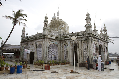

and Mahim daragah

However with the invasion by Portuguese the rule of Mughal emperors came to an end.
The Portuguese in Mumbai:
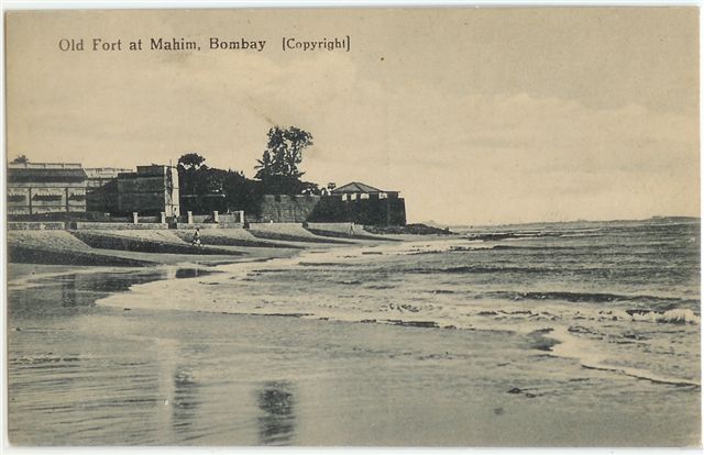 |
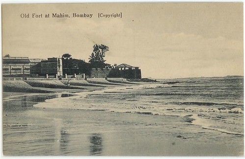
| mahim fort |

Frol de la mar or Flor de la Mar (Flower of the Sea) was a Portuguese nau (carrack) of 400 tons, which over nine years participated in decisive events in the Indian Ocean until her sinking in 1512. There traveled Afonso de Albuquerque returning from the conquest of Malacca, with a huge booty and treasure to the Portuguese king, lost off the coast of Sumatra, making it one of the mythical lost treasures.


 Afonso de Albuquerque, the Great
 |
| BANDRA PORTUGUESE FORT ;AT BANDRA,BOMBAY |

 |
ENGLISH CAMP Water-colour painting of a military encampment at the foot of a fortified hill by John Johnson (c.1769-1846). This image is from a sketch-book of 36 drawings depicting scenes chiefly in West India and Mysore, c. 1795-1801. |
 |
| CHAUL -PORTUGUESE FORT -SOUTH OF BOMBAY |
 The Portuguese arrived in India in 1498 and appropriated the west coast for their establishments. Sultan Bahadur Shah of Gujarat attacked Bombay and captured it. The Portuguese were becoming a force to be reckoned by 1560.
vasai fort -before destruction
The Battle of Vasai was fought between the Marathas and the Portuguese rulers of Vasai, a village lying near Mumbai (Bombay) in the present-day state of Maharashtra, India. The Marathas were led by Chimaji Appa, a brother of Peshwa Baji Rao I. Maratha victory in this war was a major achievement of Baji Rao I's reign.
 |
| Chhatrapati Shivaji Shahaji Bhosle छत्रपती शिवाजी राजे भोसले |
[3]Sambhaji Bhosale:-http://en.wikipedia.org/wiki/Sambhaji
Chimaji Appa:-http://en.wikipedia.org/wiki/Chimnaji_Appa
Chimaji Appa:-http://en.wikipedia.org/wiki/Chimnaji_Appa
The British in Bombay:
In 1661, King Charles II of England received ‘Bombay’ as port of the dowry and he married Princess Catherine de Braganza of Portugal. In 1668 it was handed over to the East India Company. East India Company shortly moved their main holdings from Surat to Bombay. George Oxenden was the first governor of Bombay.
The British built forts, huge custom houses and other buildings in the period, but the real development of the city began around 1857, the year of Sepoy Mutiny.
In 1858 by a special proclamation, the administration of the country itself was taken over by the queen of England, “Queen Victoria”, from the company. A Victoria wasappointed to rule the country in the name of the Queen. Politically Bombay came under the direct rule of British and this period marked the tremendous growth of Bombay.
'The oldest known names for the city
are Kakamuchee and Galajunkja; these are sometimes still used. Ali Muhammad Khan, in the Mirat-i-Ahmedi (1507) referred to the city as Manbai. In 1508, Portuguese writer Gaspar Correia used the name Bombaim, in his Lendas da Índia ("Legends of India"). This name possibly originated as the Old Portuguese phrase bom baim, meaning "good little bay", and Bombaim is still commonly used in Portuguese. In 1516, Portuguese explorer Duarte Barbosa used the name Tana-Maiambu: Tana appears to refer to the adjoining town of Thane and Maiambu to Mumbadevi.

BAMBAIM(BOMBAY)
'BONBAS' TOWN- ( MAP OF 16TH CENTURY BOMBAY )AND FORT 'BOMBAIE'


THESE 7 ISLANDS WERE JOINED TOGETHER TO FORM THE BOMBAY ISLAND:-
The inroads of the sea at Worli, Mahim, and Mahalaxmi turned the ground between the islands into swamps making Bombay an extremely unhealthy place at that time due to prevalence of Malaria. Many commuters going to the Fort by boat between islands lost their lives when there was a storm during the monsoon season. During the next 40 years much was done to improve matters. Reclamation work to stop the breeches at Mahalaxmi and Worli were undertaken. The work on the Hornby Vellard began in 1708 during the Governorship of Mr. William Hornby (1771 to 1784). The directors of the East India Co. objected to the expense of its construction, but Hornby did not give orders to stop the work and it was completed in 1784. In 1803 Bombay was connected with Salsette by a causeway at Sion (1803). The island of Colaba was joined to Bombay in 1838 by a causeway now called Colaba Causeway.
.


 READ ABOUT WILD ANIMALS IN BOMBAY>> http://oldphotosbombay.blogspot.com/2010/06/how-mumbai-lost-its-animal-instinct.html
1853-BOMBAY CITY VIEW FROM MALABAR HILL;CHOWPATTY BEACH SEEN NEAR;ST THOMAS CHURCH TOWER SEEN IN DISTANCE ;NEAR HARBOUR


late four from J M Gonsalves' 'Views at Bombay'. During the 1820s, institutions for currency production were constructed in various parts of India including Bombay, Benares and Calcutta. These imposing Doric structures can be seen to represent the feeling of growing political power of the English. The Bombay Mint was constructed between 1821and 1829 on the site of the Fort rubbish dump. The architect was John Hawkins of the Bombay Engineers. The building on the right of the picture is the Town Hall.
 icture of six 'Native Judges and Officers of the Court of the Recorder, at Bombay', at the beginning of F W Blagdon's book, 'A Brief History of Ancient and Modern India'. According to Blagdon, these drawings 'were taken from life in 1758' and are labelled respectively as holding the following positions. '1. Judge of the Hindoo Law, Antoba Crustnagee Pundit. 2. Interpreter, Rhowangee Sewagee. 3. Hindoo Officer, Lellather Chatta Bhutt. 4. Judge of the Mohomedan Law, Cajee Husson. 5. Officer to the Mooremen, Mahmoud Ackram of the Codjee order or priesthood of the cast of Moormens. 6. Haveldar, or summoning Officer, Mahmound Ismael'.
 1838.
1838.
Engraving of the Grant Medical College showing part of Sir Jamsetjee Jeejeebhoy's Hospital in Bombay by G. R. Sargent from his own drawing and published by him in London in 1844. The engraving was printed by M & N Hanhart. The Grant Medical College and the Jamsetjee Jeejeebhoy Hospital were built in the 1840s and funded jointly by Jamsetjee Jeejeebhoy and the East India Company. Jamsetjee Jeejeebhoy (1783-1859) was a Parsi merchant and eminent philanthropist. The Grant Medical College is shown in the foreground of this view. It was named after Sir Robert Grant, the Governor of Bombay between 1835 and 1838.

Coloured lithograph by Vincent Brooks of the inlet tower, with a portion of the principal dam, of the Vehar Reservoir of the Bombay Waterworks at Bombay in Maharashtra, dated c.1857.


Photograph of a group of pupils from the Juggunath Shankarset Girls' School at Bombay in Maharashtra from the Archaeological Survey of India Collections: India Office Series (Volume 46), taken by an unknown photographer in c. 1873. This image of pupils posed on the verandah was probably shown at the Vienna Exhibition of that year. On the photograph, there is a letterpress caption, above the main caption, which reads "Student's Literary & Scientific Society, founded 1848. President Dr Bhau Daji." S.M. Edwardes wrote in The Gazetteer of Bombay City and Island (3 vols, Bombay (1909-10), "...The Students' Literary and Scientific Society, which supported nine vernacular free schools for girls, attended by 654 pupils, of whom 136 were Marathi-speaking Hindus, 120 Gujarati Hindus and 398 Parsis...The formation of this society was promoted by Professor Patton of the Elphinstone College in 1848. It was intended by the student and assistant teachers of the Elphinstone Institution to be a mutual improvement society and to aid the dissemination of knowledge by means of vernacular lectures and the publication of cheap periodicals in the vernacular languages..

Photograph of pupils of the Alexandra Native Girls' Institution at Bombay in Maharashtra from the Archaeological Survey of India Collections: India Office Series (Volume 46), taken by an unknown photographer in c. 1873. This image was probably exhibited at the Vienna Universal Exhibition of the same year. Female education in india grew dramatically in the latter part of the nineteenth century. The Imperial Gazetteer of India states regarding female education, "The Government did not take up the subject until 1849, when Lord Dalhousie informed the Bengal Council of Education that henceforth its functions were to embrace female education, and the first girls' school recognized by Government was founded shortly afterwards by a committee of native gentlemen. The despatch of of 1854 directed that female education should receive the frank and cordial support of Government...The Education Commission of 1882 advised that female education should receive special encouragement and special liberality...The adoption of this attitude has resulted in a considerable development of the public instruction of girls, although it still lags far behind that of their brothers. In 1871 there were 134 secondary and 1,760 primary girls' schools; in 1901-2 the numbers were 461 and 5,628 respectively.
Lithograph of a view of Colaba by Jose M. Gonsalves (fl. 1826-c.1842) plate 3 from his 'Lithographic Views of Bombay' published in Bombay in 1826. Gonsalves, thought to be of Goan origin, was one of the first artists to practice lithography in Bombay and specialised in topographical views of the city. Colaba was originally the southernmost of Bombay's seven islands and named after the Koli fishermen who lived here. The island was visited by the English residents of Bombay for recreation from the 18th century and also used as a military cantonment in the 19th century. Colaba was connected to Bombay by a causeway that was only accessible at low tide by 1838. Within six years, Colaba became the new centre for the cotton trade
READ BOMBAY FORT NEWS 1850'S> http://oldphotosbombay.blogspot.com/2009/02/garrison-of-bombay-1845-87.html

Info- about Bombay life inside the fort :- manners,pricesof drinks,wages-1850's:- http://www.blogger.com/post-edit.g?blogID=2352176008720833167&postID=3700163255675270539


*"Hindoostanee Dhoolie, used by Hospitals and in the Field"*, 1857


Photograph of pupils in a class of the Elphinstone High School at Bombay in Maharashtra from the Archaeological Survey of India Collections: India Office Series (Volume 46), taken by an unknown photographer in c. 1873. This image of pupils gathered around a table conducting an experiment, possibly in physics, was shown at the Vienna Exhibition of the same year. The school shown here is named after Mountstuart Elphinstone who helped to establish the educational structure of the Bombay area. The Imperial Gazetteer of India states, "There are three classes of secondary schools - the vernacular and English middle schools, and the high schools...The English secondary school stage is divided into middle and high school sections, which really form portions of the same course...the English school education should ordinarily be completed by the time the pupil attained the age of sixteen...In English secondary schools the main course has hitherto led up to the matriculation or entrance examination of one or other of the Universities. There are other courses of a more practical character leading up to different examinations...A purely literary education has been more popular among both parents and students, as being in itself more attractive to them and as affording a better opening for remunerative employment. The matriculation has generally been accepted as a qualifying test by Government and private employers as well as by the Universities, and has been regarded as the common goal of the school career."

Jagannath Shankar Shet (10 October 1800 – 31 July 1865), was a notable Indian Philanthropist and a revolutionary Educationalist. He was born in 1800 in the wealthy Murkute family of Goldsmiths of the Daivadnya Caste in Mumbai (Bombay). He was one of the founders of Elphinstone College, and Indian Railway Association that became part of the Great Indian Peninsula Railway. He was the first Indian member to be nominated to the Legislative Council of Bombay under the XXTY 26 Act of 1861, a member of the Bombay Board of Education, and also the first Indian member of the famous Asiatic Society of Bombay.

Photograph of a group of pupils from the Bhagwandas Purshottum Girls' School at Bombay in Maharashtra from the Archaeological Survey of India Collections: India Office Series (Volume 46), taken by an unknown photographer in c. 1873. This image of pupils posed on the verandah was probably shown at the Vienna Exhibition of that year. On the photograph, there is a letterpress caption, above the main caption, which reads "Student's Literary & Scientific Society, founded 1848. President Dr Bhau Daji." S.M. Edwardes wrote in The Gazetteer of Bombay City and Island (3 vols, Bombay (1909-10), "...The Students' Literary and Scientific Society, which supported nine vernacular free schools for girls, attended by 654 pupils, of whom 136 were Marathi-speaking Hindus, 120 Gujarati Hindus and 398 Parsis...The formation of this society was promoted by Professor Patton of the Elphinstone College in 1848. It was intended by the student and assistant teachers of the Elphinstone Institution to be a mutual improvement society and to aid the dissemination of knowledge by means of vernacular lectures and the publication of cheap periodicals in the vernacular languages..."

BELOW:-
BOMBAY 1850Photograph
from 'Views in the island of Bombay' by Charles Scott,1850s. This is a view looking north along Apollo Street from the Apollo Gate towards the dockyards entrance on the right.
The Scotch Church
stands in the left foreground, with Hornby House beyond. The classic Georgian style Saint Andrew's or Scotch Kirk was completed in 1819.
Hornby House,
which initially began as a residence to the Governor Hornby, served as the Law Court until the late 1870s when it became the Great Western Hotel.
Between this building and the church, stands the domed
Ice-House,
erected by subscription in 1843 for the consignments of ice which were imported regularly and sold to the public. When ice began to be manufactured in Bombay the Ice-House lost its purpose and was used as a godown until it was demolished years later.
{ SHOWS HORSE CARRIAGES AND BULLOCK CART CARRIAGES PARKED NEXT TO COURT HOUSE;AND A MAN WAITING FOR CUSTOMERS WITH HIS PALANQUIN NEAR CHURCH STEPS;FORT BOMBAY.
'THE ICE HOUSE':-
-SEEN AS A WHITE ROUND HOUSE AND A WHITE ROUND ROOF}
.The ice-house was a double-shelled structure,twenty-five feet square on its outside dimension, nineteen feet square on the interior, and sixteen feet high. It held about 150 tons of ice. ICE WAS HARVESTED FROM PLACES NEAR TO THE NORTH POLE AND FROZEN LAKES.,BROUGHT BY SHIP AND KEPT FOR USE. [ELECTRICITY /REFRIGERATION Were NOT YET DISCOVERED].
Once inside, the blocks were piled together as closely as possible to prevent all unnecessary melting. The workmen in the ice-houses pried loose the stored ice by means of chisels.Wenham Lake ice enjoyed its greatest popularity in England between the year 1844 and the early years of the 185o's. It was in demand everywhere, and it grew into such vogue that London hotels put up signs informing their customers that Wenham Lake ice was served there.Main customers were the local coffee-house owners who bought the ice for the manufacture of their ice-creams.
READ ALSO how ice was brought to Bombay from America by ship:- :-http://oldphotosbombay.blogspot.com/2011/02/how-ice-came-to-india-1833.html
http://oldphotosbombay.blogspot.com/2011/02/story-of-ice-and-icecreamin-bombay-19th.html


see also daily life and actvities inside bombay fort 1850's>>http://oldphotosbombay.blogspot.com/2011/02/bombay-fort-mapsphotospaintingsnews1600.html
PHOTO BELOW SHOWS:-
THE ORIGINAL CHURCH GATE OF BOMBAY FORT;
MORE PICTURES AND PHOTOS OF FORT BOMBAY 1850'S:- http://oldphotosbombay.blogspot.com/2010_07_04_archive.html
also read ABOUT HARVESTING OF ICE FROM FROZEN LAKES AND FIELDS FOR EXPORT TO FAR OFF PLACES INCLUDING INDIA 1850'S>> :-http://www.iceharvestingusa.com/Frederic%20Tudor%20Ice%20King.html


Bombay,[BULLOCK CART FOR PASSENGERS] a photo by Francis Frith, c.1870'


Bombay showing the fort," from 'History of the Indian Mutiny', 1858*

*"The Hon. East India Company's fleet of transports and war-steamers in Bombay Harbour, previous to their departure for the Persian Gulf," Illustrated London News, 1857*

*"Landing at the Dockyard, Bander, of the remains of Lord Frederick Fitzclarence," Illustrated London News, 1855*

*"Native entertainment to European troops at Bombay," from the Illustrated London News, 1858*
 * view of Bombay during the fire of 1803, an aquatint by J. S. Barth
 *"Scene in Bombay
THE GREAT FIRE INSIDE BOMBAY FORT AND PHOTOS 1803>>> http://oldphotosbombay.blogspot.com/2011/02/bombay-fort-mapsphotospaintingsnews1600.html
BOMBAY - CHURCH GATE RAILWAY STATION--1910's


![[flora+fountain.jpg]](//2.bp.blogspot.com/_iZMWbgTP0b4/SZ23u9AbXUI/AAAAAAAABUw/xWi8AEZJdq0/s640-rw/flora%2Bfountain.jpg)


HORSE CARRIAGES WAITING IN FRONT OF TAJ MAHAL HOTEL BOMBAY


BOMBAY CLUB1880'S


BELOW -WATSON [LUXURY ]HOTEL BOMBAY

ADELPHI HOTEL BOMBAY


BELOW PHOTO 1880'S-METRO THEATER AREA? CARS YET TO BE BORN!


ONLY HORSE CARRIAGES AND TRAMS
BELOW BOMBAY VICTORIA MEMORIAL RAILWAY STATION (NOW C.S.T. STATION)-B.C. [MEANS BEFORE CARS-1890'S ]

"Embarking elephants at Bombay for the Abyssinian expedition," from the Illustrated London News, 1868: very large scans of the *left half* and the *right half* of the engravin

BELOW:-"KALA GHODA"STATUE;SEEN STANDING IN FRONT OF SASSOON LIBRARY AND Elphinstone College
{Kala Ghoda (Marathi: काळा घोडा) is a precinct or district in South Mumbai, India.
The name means Black Horse, a reference to a black stone statue of King Edward VII (as the then Prince of Wales) mounted on a horse it was actually build by the famous Jewish businessman and the greatest person who contributed a lot to the city of mumbai Sir David Sassoon who owned Most of the property of this area later also a Library and a lane named after him . Although this statue was removed in 1965 to storehouses of the Bhau Daji Lad Museum (formerly the Victoria & Albert Museum (Mumbai)) in Byculla, Central Mumbai, the name persists. The statue is now in the Jijamata Udyan in Byculla.}

"The Plague in Bombay: House to House Visitation,BY DOCTOR" from the Illustrated London News, 1898 (with modern hand coloring)

BELOW -STANDING IN MIDDLE OF ROAD IS THE BOMBAY POLICE MAN


'GATE WAY OF INDIA' BUILT HERE LATER; ALSO (PHOTO BELOW)


http://oldphotosbombay.blogspot.com/2011/02/old-postcards-of-bombay-mumbai.html
OFFICER SITS ON HAND PULLED RICKSHAW;


A 1905 Humber car , photographed in Bombay-(ONE OF THE FIRST CARS IN BOMBAY)


FIRST FLEET OF TAXI CARS IN BOMBAY 1910;THE PASSENGER SAT IN THE COVERED CABIN WHILE THE TAXI DRIVER SAT IN THE OPEN FRONT ;JUST SAME ARRANGEMENT AS A HORSE CARRIAGE


TAXIS IN NEW YORK 1914-SIMILAR 20 CARS WERE IMPORTED FOR USE AS TAXI IN INDIA ;MAINLY FOR CALCUTTA,BOMBAY
 Mr Jinnah on a car ride with a Parsi friend


NEW CAR SHOW ROOM 1910

DE DION BUTON CAR-1912-cars mostly handle start;self starting cars were made from 1912 onwards

THE MAN STARTING HIS CAR ; (BY CRANKING THE STARTING HANDLE WAS THE ONLY WAY ,BEFORE SELF STARTER WAS DISCOVERED)
CARS 1920 CALCUTTA

MAHATMA GANDHI ;NEAR CAR 1930'S

1920 -30 TAXI CARS ;NO CARS WERE MADE IN INDIA THOSE DAYS .SO ALL CARS WERE IMPORTED FROM AMERICA BRITAIN FRANCE OR GERMANY [.JAPANESE CARS BECAME POPULAR AFTER 1960]
CAR 1920-CROSSLEY


below :- flora fountain 1920's

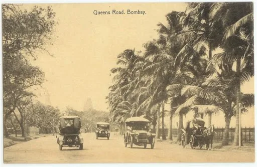
cars on the road in india- THERE WAS NO 'A' OR 'B' OR 'C' JUST THE NUMBER FOR THE CAR--SEE BELOW THE CAR REGISTRATION NO: JUST '26903'.THIS WAS WHEN NUMBER OF CARS WERE VERY FEW-PHOTO OF CALCUTTA 1930'S


 Patent drawing for a Fan Moved by Mechanism, 27 November 1830.A PUNKAH[HAND PULLED FAN] PULLER IS EMPLOYED TO PULL THE PUNKAH CORD ,FROM OUT SIDE THE WINDOW .THE MECHANISM IS SIMPLE:- HE PULLS THE CORD ENOUGH TO MAKE THE MADE OF, MAT FAN ;ALL THE WAY TO THE WINDOW AND THEN HE LET GO THE CORD TILL THE FAN GOES BACK AUTOMATICALLY TO THE ORIGINAL POSITION.IT IS A PRETTY BORING JOB TO PULL CORD AND LET GO REPEATEDLY FOR HOURS AT A TIME .I COMPARE SUCH REPETITIVE BORING WORK; EQUAL TO THE SLAVE OAR PULLERS OF ANCIENT ROMAN SHIP ;WHO HAD TO ROW AND ROW FOR HOURS

Bombay Electric Supply & Tramways Company Limited was a sole provider of electric supply, electric tram service and buses in the Mumbaicity from 1905 to till 1947 when it was municipalised to form the Bombay Electric Supply and Transport Undertaking. [BELOW PHOTO OF B.E.S.T.BUS 1920'S;AND B.E.S.T.'S SINGLE DECKER AND DOUBLE DECKER TRAMS,]


private taxi van 1930's [SEE THE BOMBAY REGISTRATION NO: B.M.B.210]

AND BUS1930'S

MARRIAGE TAXIS[OPEN HOOD CARS];HIRED ALONG WITH BAND WAS COMMON


http://oldphotosbombay.blogspot.com/2011/02/travel-by-ship-before-1960-bombay-to.htmlhttp://oldphotosbombay.blogspot.com/2011/02/travel-by-ship-before-1960-bombay-to.html
1940'S TAXI CARS

MAHATMA GANDHI ENTERING CAR -1940'S PHOTO

1940 TAXIS -CHEVEROLETCARS

 A rare photo of all the singers together in the early years of their singing careers ! Can you spot
( front row) Zohra Jan, Rajkumari, Amirbai Karnatki, Hamida Banu, Geeta Roy (later Geeta Dutt), Lata Mangeshkar, Meena Kapoor, (and standing behind) Sailesh Mukherjee, Talat Mahmood, Dilip Dholakia, Mohd. Rafi, Shiv Dayal Batish, G.M. Durrani, Kishore Ganguli (later Kishore Kumar), and Mukesh.
RATAN (1944)
Sung by Zohrabai Ambalawali
Music composed by Naushad
Lyrics by D.N. Madhok
1942 FORD CARS AND TRUCK

1940'S FORD TRUCK

1940-50 BOMBAY MARINE DRIVE
 1950'S BOMBAY FLORA FOUNTAIN SHOWING ELECTRIC TRAMS ON ROAD,AND TAXIS(ALL FOREIGN CARS ;NO INDIAN CARS THEN; FORD , CHEVROLET,AUSTIN,)


1942 FORD JEEP AS TAXIS WERE USED FOR HILLY TERRAIN


1944 FORD VAN WITH WOODEN BODY

1944 FORD MILITARY TRUCK WERE CONVERTED TO CIVIL LORRIES AND WERE USED AS BREAKDOWN TRUCK IN BOMBAY TILL 2000

1945 FORD WAS VREY POPULAR AS PRIVATE CAR AND AS TAXIS TILL 1980
BELOW (THE POPULAR) FORD CAR 1948 -USED FOR WEDDINGS AND AS TAXI


AND 1946 FORD VAN WITH WOODEN BODY

1950'S HILLMAN TAXI OF BOMBAY[MADE IN ENGLAND]

TAXI DRIVER (1954) HINDI MOVIE[ACTORS DEV ANAND AND KALPANA KARTIK-LATER THEY GOT MARRIED IN REAL LIFE]

BOMBAY TAXI BMT 1800-C.1950'S

PONTIAC CAR[MADE IN AMERICA] AS TAXI


HILLMAN MINX MADE IN BRITAIN WAS VERY POPULAR AS TAXI IN BOMBAY TILL 1970


AUSTIN CAR AS TAXI-1950'S NEAR A HOTEL

AUSTIN A40 TAXI CAR [MADE IN ENGLAND]

THE FIRST CAR TO BE CONVERTED INTO A INDIAN CAR--MORRIS MINOR ENGLAND WAS MADE INTO HINUSTAN CAR 1950-SEEN BELOW

MORRIS MINOR(LATER RENAMED BAY HINDUSTAN) TAXI CAR C.1950'S

BABY HINDUSTAN CAR-FIRST CAR TO BE MADE IN INDIA [COPIED FROM MORRIS MINOR ENGLAND]C.1950

ANOTHER CAR WHICH WAS CONVERTED INTO AN INDIAN CAR-MORRIS OXFORD INTO HINDUSTAN LAND MASTER AND LATER INTO AMBASSADOR-SEE BELOW


1956 FIAT MILLICENTO ALSO KNOWN AS DUKKER FIAT -USED AS TAXI IN 1960'S

BMC (BOMBAY)7921


LATER MODEL FIAT -KNOWN AS PREMIER PADMINI BELOW

1960 Tata Mercedez Benz trucks in India

STANDARD CARS MADE IN MADRAS (CHENNAI) CALLED HERALD / TRIUMPH; A FEW USED AS TAXIS IN SOUTH INDIA

ENGLISH MAN'S LIFE IN INDIA 1850'S

CLICK AND READ THIS BOOK>>>>> >> "Curry & rice," on forty plates;
are Kakamuchee and Galajunkja; these are sometimes still used. Ali Muhammad Khan, in the Mirat-i-Ahmedi (1507) referred to the city as Manbai. In 1508, Portuguese writer Gaspar Correia used the name Bombaim, in his Lendas da Índia ("Legends of India"). This name possibly originated as the Old Portuguese phrase bom baim, meaning "good little bay", and Bombaim is still commonly used in Portuguese. In 1516, Portuguese explorer Duarte Barbosa used the name Tana-Maiambu: Tana appears to refer to the adjoining town of Thane and Maiambu to Mumbadevi.
Gerald Aungier
Gerald Aungier was the second Governor of Bombay. He was made the president of the Surat factor and the governor of Bombay in 1672, which posts he held till 1675. He was responsible for the initial growth of the city. He died in the year 1677.Although the Portuguese king had ceded all the islands of Bombay to the British king Charles, the Portuguese in India refused to hand over the the territory. It was not till 1675 that Aungier actually took possession of Colaba and Old Man's Island, thus completing the transfer of power to the British. His plan of fortifying the main island, from Dongri in the north to the harbour, had to wait until 1715 for completion, when Charles Boone became the governor of the town.
ALL WELCOME,FROM ANY ANY PLACE IN INDIA TO BOMBAY SAID AUNGIERlHe offered various inducements to skilled workers and traders to set up business in Bombay. His offers were tempting enough to lure many traders and artisans from Gujarat to the newly developing town. As a result Bombay registered its first population boom. Between 1661 and 1675 there was a six-fold increase in population.
Aungier established the first mint in Bombay, 

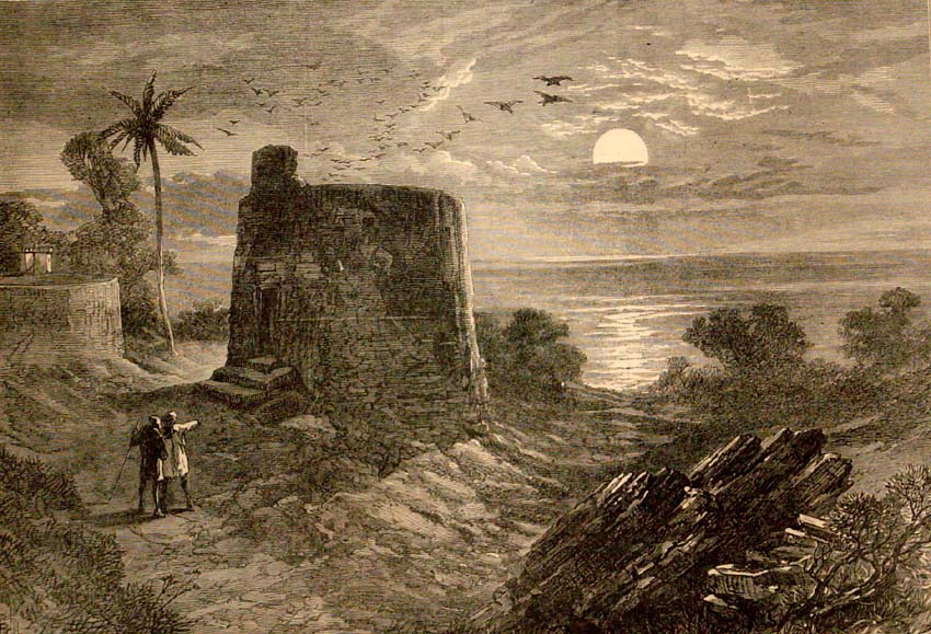
and ceded land near the Malabar hill to immigrant Parsiworkers and traders for a Tower of Silence.
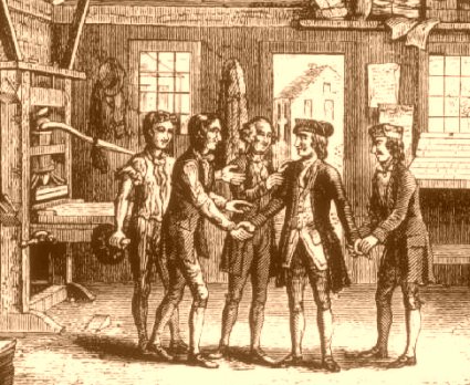
It was during his governorship, in 1670, that the first printing press was imported and set up in Bombay.
http://en.wikipedia.org/wiki/Bhimjee_Parikh
[Bhimji Parikh (b.?-1686) was a bania born in Surat. He is remembered today primarily for having introduced the firstprinting press,[2] to Bombay in 1674-75.]

[Bhimji Parikh (b.?-1686) was a bania born in Surat. He is remembered today primarily for having introduced the firstprinting press,[2] to Bombay in 1674-75.]
In Bombay, Governor Aungier formed a militia of local Bhandari youth to deal with organized street-level gangs that robbed sailors in 1669. Thus, Bhandari Militia was the first police establishment in Mumbai(then Bombay) during British India.

BAMBAIM(BOMBAY)
 |
| BAMBAIM(BOMBAY)MUMBAI-portugese map 1630 |
'BONBAS' TOWN- ( MAP OF 16TH CENTURY BOMBAY )AND FORT 'BOMBAIE'
 |
| FORT DE BOMBAIE(BOMBAY) |
 | |
| MAP SHOWS FORTS AT BANDURA(BANDRA) MAYEN(MAHIM)MAZEGOEM(MAZGAON);CAYMAN(SION)AND BOMBAY FORT |
 | |
| BACAIM(VASAI) FORT AND BOMBAY FORT SEEN IN MAP READ -CAPTAIN KIDD THE PIRATE IN BOMBAY BEFORE HE WAS CAUGHT IN NEWYORK:- http://oldphotosbombay.blogspot.com/2009/02/kidd-pirate.html |
 |
| MAP OF BOMBAY BY FRENCH NAVIGATORS |
 |
| MAP OF CAMBAY SHOWING BOMBAIM(BOMBAY) AND MAIM(MAHIM) |
1670--View of Bombay (East India men flying Company’s Ensigns). - by Edward http://oldphotosbombay.blogspot.com/2010/12/1670-view-of-bombay-east-india-men.htmlhttp://oldphotosbombay.blogspot.com/2010/12/1670-view-of-bombay-east-india-men.html
 |
The Fort, Bombay, Harbour face wall,-GUNS POINTING DOWN INTO MOAT 1863.--Date: 1863--Photogrph |
The inroads of the sea at Worli, Mahim, and Mahalaxmi turned the ground between the islands into swamps making Bombay an extremely unhealthy place at that time due to prevalence of Malaria. Many commuters going to the Fort by boat between islands lost their lives when there was a storm during the monsoon season. During the next 40 years much was done to improve matters. Reclamation work to stop the breeches at Mahalaxmi and Worli were undertaken. The work on the Hornby Vellard began in 1708 during the Governorship of Mr. William Hornby (1771 to 1784). The directors of the East India Co. objected to the expense of its construction, but Hornby did not give orders to stop the work and it was completed in 1784. In 1803 Bombay was connected with Salsette by a causeway at Sion (1803). The island of Colaba was joined to Bombay in 1838 by a causeway now called Colaba Causeway.
.
MOMBAIM (BOMBAY)
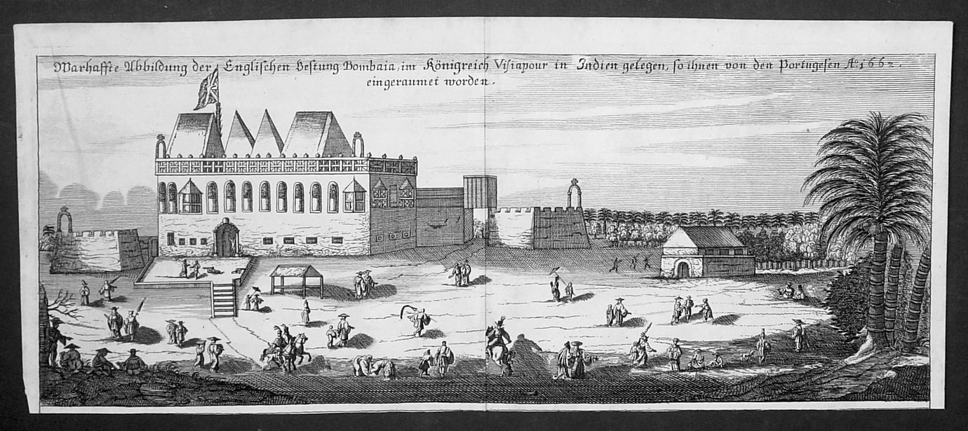
BOMBAJA FORT(BOMBAY) 1700
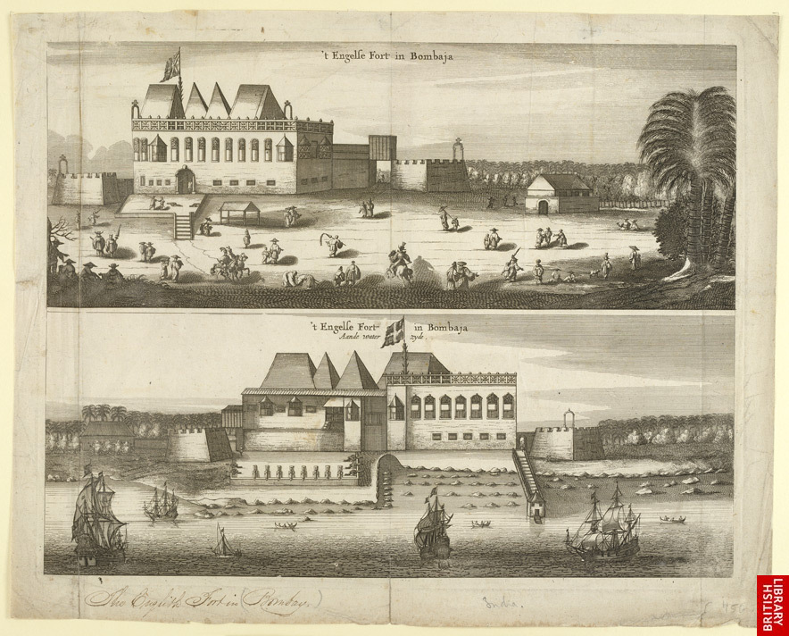
BOMBAIA (BOMBAY)-16TH CENTURY MAP
 |
| DURING THIS PERIOD THE BRITISH FLAG WAS FLYING OVER BOMBAY AND AMERICA |
 | |
| Former type | Public |
|---|---|
| Industry | International trade |
| Founded | 1600 |
| Defunct | 1 January 1874 |
| Headquarters | London, United Kingdom |
 The East Indiaman Repulse (1820) | |
| Colonial India | |
|---|---|
| Portuguese India | 1510–1961 |
| Dutch India | 1605–1825 |
| Danish India | 1620–1869 |
| French India | 1759–1954 |
| British India 1613–1947 | |
| East India Company | 1612–1757 |
| Company rule in India | 1757–1857 |
| British Raj | 1858–1947 |
| British rule in Burma | 1824–1867 |
| Princely states | 1765–1947 |
| Partition of India | |
 | |||||||
VIEW OF SOUTH BOMBAY 1820 -MAZGAON AREA NEWS FROM BOMBAY FORT GARRISON http://oldphotosbombay.blogspot.com/2009/02/garrison-of-bombay-1845-87.html  Lithograph of Bombay harbour by W. Watson after Charles Franklin Head from his 'Eastern and Egyptian Scenery' printed by C.Hullmandel and published in London in 1833 |
 |
The Hornby Vellard was a project to build a causeway uniting all seven islands of Bombay into a single island with a deep natural harbour. The project was started by the governor William Hornby in 1782 and all islands were linked by 1838. The word vellard appears to be a local corruption of the Portuguese word vallado meaning fence or embankment.[1] It was completed in 1784 and was one of the first major civil engineering projects which transformed the original seven islands of Bombay into one island. Work on the vellard was started in 1782 by William Hornby, then Governor of Bombay, against the wishes of the directors of theEast India Company. The purpose of this vellard was to block the Worli creek and prevent the low-lying areas of Bombay from being flooded at high tide. The cost was estimated at about Rs. 100,000. According to some accounts, Hornby ordered the work to be started after the East India Company turned down his proposal; and continued as Governor till the end of his term in 1784, ignoring the suspension notice sent to him. One story of the origin of the Mahalaxmi temple links it to a vision of a statue of Laxmi in the sea. The chief engineer dreamed of the statue following multiple collapses of the sea-wall; recovered it, and built the temple as an offering for safe construction of the vellard. |

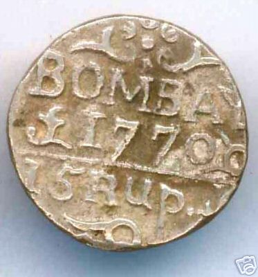
BOMBAY ENGLISH COIN 1770 -15 RUPEES
1853-BOMBAY CITY VIEW FROM MALABAR HILL;CHOWPATTY BEACH SEEN NEAR;ST THOMAS CHURCH TOWER SEEN IN DISTANCE ;NEAR HARBOUR
also see -A photograph of a view of Bombay from Malabar Hill from the 'Vibart Collection of Views in South India' taken by an unknown photographer about 1855
ALSO photos of bombay http://oldphotosbombay.blogspot.com/2010_07_04_archive.html

 MALABAR HILL FOREST


 1861, Nov. 26th. — Hyenas quite common at night, prowlingnabout the Byculla Flats.


ALSO photos of bombay http://oldphotosbombay.blogspot.com/2010_07_04_archive.html
 |
| VIEW BOMBAY FROM MALABAR HILL 1850'S |
BOMBAY HOTELS 1850'S http://oldphotosbombay.blogspot.com/2009/02/bombay-1800-1900-bombay-hotels.html
BELOW ANOTHER VIEW OF BOMBAY FORT AND HARBOR
TRAVEL BY SHIP:- http://oldphotosbombay.blogspot.com/2011/02/travel-by-ship-before-1960-bombay-to.html
  |
| The Fleet under Convoy of H. M.'s Ship 'Chiffone' Captain Wainwright leaving Bombay'. Coloured aquatint by J. Clark after Robert Temple. H.M. 65th Reg. Sept. 14, 1809. From the Apollo Gate[COLABA ISLAND SEEN IN FRONT OF HARBOR] |
 |
MAHIM CHURCH AND MITHI RIVER (before people converted the river into a sewer) |
Glimpses of old Bombay and western India, with other papers (1900)
THE WILD BEASTS OF BOMBAY. /TIGER AT MAHIM,HYENA AT BYCULLA,TIGER AT ESPLANADE,TIGER AT MAZGAON,HYENA AT MALABAR HILL,TIGER AT GOWALIA TANK
 MALABAR HILL FOREST
THE WILD BEASTS OF BOMBAY.
1783. — The Governor and most of the gentlemen of Bombay
go annually on a party of pleasure to Salsette" to hunt the wild
boar and royal tiger, both of which we found here in great
plenty. — Hector Macneill.
1806, December 17th. — Two gentlemen at 7 a.m. riding
towards the bungalows of General Macpherson on the Island of
Salsette, near the village of Coorla, two tigers came out of the
jungle as if ready to spring, crouched, and were observed to
betake themselves to the jungles and hills of Powee, fifty yards
in front of the horses.
And in this connection two persons on November 4th
were carried off by two tigers from a native village nearly
opposite to Powee, near the high road leading from Sion to
Tanna. The natives believe the tigers are human beings, and
have gold rings in their ears and noses.
One native's body they had sucked all the blood out of it,
otherwise not eaten. They took away a herdsman driving
his fl^ck.
1819, — There were in all only three deaths recorded in
India of Europeans from snake-bites in the years 1817, 1818
and 1819.
1820, December 23rd. — A large lion killed within eight coss
from Ahmedabad.
1822, February 9th. — A tiger on Malabar Hill came down,
quenched his thirst at Gowalla Tank, and ran off over the hill
between the Hermitage and Prospect Lodge. Prints of its feet
were distinctly visible this morning.
1828. — At Colaba Ferry a huge shark was observed in
proximity to some bathers.
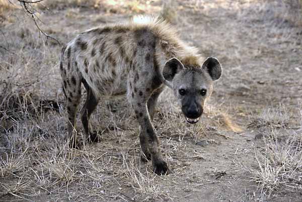
1830, January 13th. — A large hyena is prowling about
Malabar Hill on the western side between Mr. Nicol's residence
and Vaucluse, " as good sport as a Mazagon tiger." — Bombay
Gazette.
"Tiger hunt, " an engraving,
1839, June 25th. — Lieutenant Montague, at Colaba, returning
from mess, put his foot in a hole, received a slight wound which
in twenty-five minutes carried him off. Some jurors thought it
was from the bite of a serpent.
1841, September 15 th. — A man bitten by a snake on the
Esplanade.
“]![A painting shows a tiger entering a village. [Bombay Natural History Society]](https://lh3.googleusercontent.com/blogger_img_proxy/AEn0k_t4uLT5zbkV4VBbawLk21Ct38ORa306JPSmtw2nKGGuY5kKa12kmU6XpvDoqxokBM6SjTcFcox1NfRz8x6a3CxMFtzvsj12YYp16fbrbAqyiulN5dBs9RwWgMDn3IGjVejcBe4alPGQ=s0-d "tiger_book")
A painting shows a tiger entering a village. [Bombay Natural History Society]
1849. — A finback whale driven on shore at Colaba, 60 feet
long, 30 to 40 feet round the thickest part. All along the road
from the Fort to Colaba was a perfect fair. . The stench was felt
from the town side of the causeway from where it lay at the
back of Colaba Church. Jawbone taken away. — Gentleman s
Gazette.
1850, Oct. 9th. — A tiger at Bandoop leaped upon the mail-
cart and upset it, and the ghiarry-wallah was little injured. I
saw jackals several times in the gardens of the Colaba Observa-
tory in 1844. — Dr. Buist. On tins Mr. Charles Chambers, F.K.S.,
observes (1893) : " I found a jackal in my bedroom in the
Colaba Observatory about fifteen years ago."
A jackal was killed in the new High Court Buildings shortly
after they were finished.
1858, March 3rd.— Some officers of the P. and 0. steamer
Aden observed a tiger swimming from Mainland to Mazagon.
A boat was lowered and the crew armed with ship's muskets.
When they came up to it the brute was boarding a buggalow,
and was being kept off by the lascars by handspikes. It was
shot through the head by six balls. Weight, 353 lbs. Length
to tip of tail, 8 ft. 9 ins.

1858, May 26th. — A young Portuguese this day shot a tiger
at Mahim, and on the 27th inst. brought the carcass to the
Chief Magistrate for the reward,
1859. — To-day Mr. Forjett with a fowling-piece shot a tiger
within a few hundred yards of the fashionable drive on the
Esplanade, and on the beach of Back Bay near Sonapore. Mr.
Forjett promised the hide to Dr. Birdwood for the Museum.
—Bombay Gazette.
Feb. 6th. — On this day, Sunday evening, the wife of Mr.
Pratt, uncovenanted assistant in the General Department Secre-
tariat, walking along with her husband in the fields adjoining
their residence at Mahim, trod on a snake and died two hours
afterwards. — Bombay Gazette.
Feb. 15th. — ■A tiger was seen sloping about the nooks of
Kalbadavie, but disappeared.
Nov. 12th. — Dr. Turner, P. and 0. service, at his residence,
Chinchpoogly, was bitten by a venomous snake on the calf of
the leg. His leg swelled to an immense size. A friend of his
made an incision, sucked the wound, and he is now recovering.
Kov. 16th. — A cobra, 4 ft. in length, killed in Secretariat
compound, Apollo Street.
1860, Oct. 31st. — On Sunday a snake was seen amusing
itself round one of the pillars in St. John's Church, Colaba, a
few yards from the reading-desk, and not long ago a cobra was
found in the organ. — Times and Standard.
Dec. 5 th. — A hyena shot while devouring a bullock not far
from the Byculla Club House.

1863, Jan. 25th.— Tiger at Mahim, near railway station.

1870-THE ENGLISH GOVERNOR GENERAL OF INDIA -ON TOUR
INDIAN TROOP SHIP -1870-IN STORM --BOMBAY CYCLONE
1872-TRAVELLING IN INDIA-MEN CARRY THE TRAVELER
BELOW VIEW OF BOMBAY 1854--
[1]VIEW OF THE WILD DESOLATE LANDSCAPE
[2]FROM SION HILL SHOWING A STEAM TRAIN.
[3]BELOW THE BYCULLA RAILWAY STATION(HUT)& 2
HORSE CARRIAGES [TAXI]
 |
BAZAR GATE AREA, BOMBAY FORT SHOWS HARBOUR BUILDINGS- A PALANQUIN TAXI,TENTS USED BY SOLDIERS,A WELL WITH WATER WHEEL;MAST OF SHIPS IN HARBOUR,STORAGE GODOWS |
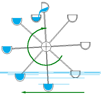 |
| A WATER WHEEL ,AS SEEN IN THE PICTURE ,ABOVE USED IN WELLS |
 |
ANOTHER LATER VIEW OF SAME BOMBAY GREEN [HORNIMAN CIRCLE] AREA  Posed group of six figures taken by Hurrichund Chintamon c. 1867, from the Archaeological Survey of India Collections. This photograph was shown at the Paris Exhibition of 1867. The European on the left is identified simply as 'A German', three other figures as 'Parsees', the figure seated on the left as Dr Bhau Dajee, and the figure seated on the right, as 'Shenoy' (?). Parsees are descendants of the Persian followers of Zoroaster who fled to India in the seventh and eighth centuries to escape Muslim persecution. Panorama of Fort, Bombay--Photographer: Dayal, Deen (1844-1905) Medium: Photographic print Date: 1885  BELOW BRITISH EAST INDIAN SHIPS IN BOMBAY HARBOUR    BOMBAY BROKERS AND TRADERS ;DOING SECRET BARGAINING UNDER TOWEL ,BY HAND TOUCH(READ THE NEWS IN SMALL PRINT)  COTTON GREEN MARKET AND BELOW PICTURE SHOWS RELIGIOUS SERVICE OF 'JAINS' IN BOMBAY  NAUTCH' GIRLS BOMBAY PALKHI WALAS(PALANQUIN CARRIERS),WAITING AT BOMBAY HARBOUR  BOMBAY DROMEDARY CORPS(BOMBAY CAMEL CORPS);ALSO PICTURE OF A THUG(DACOIT) CHIEF  THE HORSE RACE AT 'ABOO',BOMBAY PROVINCE   BOMBAY RACES CUP;ALSO-BOMBAY ADELPHI THEATRE- THE NEW -PLAY'BELPHEGOR THE MONTEBANK'  THE FIRST STEAM SHIP TO BOMBAY VIA CAPE OF GOOD HOPE-SOUTH AFRICA (BEFORE SUEZ CANAL WAS MADE) 1936   BOMBAY ST.THOMAS CATHEDRAL  |
 |
| This photograph of the city of Pune was taken by an unknown photographer in the 1860s to from part of an album entitled 'Photographs of India and Overland Route'. Pune was the eighteenth-century capital of Raja Shivaji, the Maratha king who defied the Mughal emperor Aurangzeb. In 1802 Jaswant Rao Holkar defeated the combined armies of the Peshwa and Scindia. As a result of this defeat the Peshwa invited British assistance and Pune was occupied by troops under Wellesley in 1803. After the battle of Kirkee in November 1817 it was surrendered to the British who based the summer headquarters of the Government of Bombay here and established a large military cantonment. |
 |
| POOR MAN'S PALANQUIN below-Post haste[email of last century] |
 | |||
India, Pigeon Post Collection, 1931-41.
|


 |
| POst men running with postal articles 1850's picture[ called dawk wallah by english men ;Scinde Dawk was a very old postal system of runners that served the Sindh, The term also refers to the first postage stamps in india the forerunners of the adhesive stamps used throughout India] Darius extended the network of roads across the Persian empire, to enable both troops and information to move with startling speed. At the centre of the system is the royal road from Susa to Sardis, a distance of some 2000 miles (3200 km). At intervals of a day's ride there are posting stations, where new men and fresh horses will be available at any moment to carry a document on through the next day's journey.By this method a message can travel the full distance of the road in ten days, at a speed of about 200 miles a day.other methods of communications in the past were [1]'message whistling' of canary islands[2] 'tom tom' messages by drum beats,[3]fire signal by south american indians[4] smoke signals by north american indians Read more:http://www.historyworld.net/wrldhis/PlainTextHistories.asp?historyid=aa93#ixzz1I3DbRsDn Read more:http://www.historyworld.net/wrldhis/PlainTextHistories.asp?historyid=aa93#ixzz1I3DOcxXC |
 |
| India postage 1930 - SHOWS THE 'Dak runner' |
 | ||
pigeon post during world war 1
|


late four from J M Gonsalves' 'Views at Bombay'. During the 1820s, institutions for currency production were constructed in various parts of India including Bombay, Benares and Calcutta. These imposing Doric structures can be seen to represent the feeling of growing political power of the English. The Bombay Mint was constructed between 1821and 1829 on the site of the Fort rubbish dump. The architect was John Hawkins of the Bombay Engineers. The building on the right of the picture is the Town Hall.


Engraving of the Grant Medical College showing part of Sir Jamsetjee Jeejeebhoy's Hospital in Bombay by G. R. Sargent from his own drawing and published by him in London in 1844. The engraving was printed by M & N Hanhart. The Grant Medical College and the Jamsetjee Jeejeebhoy Hospital were built in the 1840s and funded jointly by Jamsetjee Jeejeebhoy and the East India Company. Jamsetjee Jeejeebhoy (1783-1859) was a Parsi merchant and eminent philanthropist. The Grant Medical College is shown in the foreground of this view. It was named after Sir Robert Grant, the Governor of Bombay between 1835 and 1838.

The idea for the construction of a wet docks for the use of shipping in Bombay harbour was first suggested by M. Malet when member of Council in 1855. In 1866, Russell Aitken, Executive Engineer to the Municipality prepared the foundation of a Harbour and Dock Trust which could raise money for the construction of wet docks on the Elphinstone and Mody Bay reclamations as private companies had gone into a recession. In 1875, the first stone was laid in the hope that the new dock would create a prosperous revolution in the trade of Bombay. In April 1879, the Prince's Dock was thrown open by the Governor of Bombay, Sir Richard Temple. In 1884, it was decided to extend the dock and construction then began on the Victoria Dock.

Photograph with a view of a carriage on a road lined with palms at Bombay (Mumbai), Maharashtra, taken by an unknown photographer in the 1870s, part of the Bellew Collection of Architectural Views. The area known as Marine Lines at Bombay took its name from the 10th Marine Battalion of the Bombay Pioneers, composed of Indian troops led by British officers, which was stationed here in the mid-19th century.

Photograph of a group of pupils from the Juggunath Shankarset Girls' School at Bombay in Maharashtra from the Archaeological Survey of India Collections: India Office Series (Volume 46), taken by an unknown photographer in c. 1873. This image of pupils posed on the verandah was probably shown at the Vienna Exhibition of that year. On the photograph, there is a letterpress caption, above the main caption, which reads "Student's Literary & Scientific Society, founded 1848. President Dr Bhau Daji." S.M. Edwardes wrote in The Gazetteer of Bombay City and Island (3 vols, Bombay (1909-10), "...The Students' Literary and Scientific Society, which supported nine vernacular free schools for girls, attended by 654 pupils, of whom 136 were Marathi-speaking Hindus, 120 Gujarati Hindus and 398 Parsis...The formation of this society was promoted by Professor Patton of the Elphinstone College in 1848. It was intended by the student and assistant teachers of the Elphinstone Institution to be a mutual improvement society and to aid the dissemination of knowledge by means of vernacular lectures and the publication of cheap periodicals in the vernacular languages..
This view of the Esplanade in Bombay was taken by an unknown photographer in the 1860s. Originally, Bombay was composed of seven islands separated by a marshy swamp. It’s deep natural harbour led the Portuguese settlers of the sixteenth century to call it Bom Bahia (the Good Bay). The British Crown acquired the islands in 1661when Catherine of Braganza married Charles II, as part of her marriage dowry. It was then presented to the East India Company in 1668. The second governor, Gerald Aungier, developed Bombay into a trading port and centre for commerce and inducements were offered to skilled workers and traders to move here. The Esplanade, now an area known as the Maidans, is set behind Marine Drive on the western side of Colaba Causeway. Before the land on which Marine Drive was built was reclaimed from the sea, the area formed the seaside esplanade behind Chowpatty Beach.


Photograph of pupils of the Alexandra Native Girls' Institution at Bombay in Maharashtra from the Archaeological Survey of India Collections: India Office Series (Volume 46), taken by an unknown photographer in c. 1873. This image was probably exhibited at the Vienna Universal Exhibition of the same year. Female education in india grew dramatically in the latter part of the nineteenth century. The Imperial Gazetteer of India states regarding female education, "The Government did not take up the subject until 1849, when Lord Dalhousie informed the Bengal Council of Education that henceforth its functions were to embrace female education, and the first girls' school recognized by Government was founded shortly afterwards by a committee of native gentlemen. The despatch of of 1854 directed that female education should receive the frank and cordial support of Government...The Education Commission of 1882 advised that female education should receive special encouragement and special liberality...The adoption of this attitude has resulted in a considerable development of the public instruction of girls, although it still lags far behind that of their brothers. In 1871 there were 134 secondary and 1,760 primary girls' schools; in 1901-2 the numbers were 461 and 5,628 respectively.
Lithograph of a view of Colaba by Jose M. Gonsalves (fl. 1826-c.1842) plate 3 from his 'Lithographic Views of Bombay' published in Bombay in 1826. Gonsalves, thought to be of Goan origin, was one of the first artists to practice lithography in Bombay and specialised in topographical views of the city. Colaba was originally the southernmost of Bombay's seven islands and named after the Koli fishermen who lived here. The island was visited by the English residents of Bombay for recreation from the 18th century and also used as a military cantonment in the 19th century. Colaba was connected to Bombay by a causeway that was only accessible at low tide by 1838. Within six years, Colaba became the new centre for the cotton trade
READ BOMBAY FORT NEWS 1850'S> http://oldphotosbombay.blogspot.com/2009/02/garrison-of-bombay-1845-87.html
 |
| WHITE MAN ON WAY TO HILL STATION ON PALANQUIN |
Ceremony witnessing the handing of the British Crown from the East India Company to Queen Victoria:-http://oldphotosbombay.blogspot.com/2010_06_07_archive.html


| INDIANS CARRYING,ON A PALANQUIN- A WHITE WOMAN WITH A WHITE UMBRELLA IN SIMLA MALL(MAIN STREET) 19 TH CENTURY PHOTO.[INDIANS WERE NOT ALLOWED IN THE MALL AREA BY BRITISH RULERS IN THE BEGINNING BUT LATER ON ALLOWED] |

*"Hindoostanee Dhoolie, used by Hospitals and in the Field"*, 1857
 |
ANTIQUE POST CARD-SCHOOL BOYS AND TEACHER-BOMBAY.THE SCHOOL BOYS ARE USING PALM LEAF BOOKS -IN THEIR HANDS,(PROBABLY VEDA SCHOOL) |
{Palm leaves were first cut from the trees before they could dry up and become brittle. These were then boiled in water to the required temperature in order to render them soft. The softened leaves were then dried in the shade or mild sunshine. The desired portion was taken from mid-leaf, pressed and then polished. These were then cut into the required size and made into rolls of paper.Tālapatras or palm leaves of slightly yellow hew, eight angulas (inches) long, which were more brittle and hence cheaper, were given to students for copy work. The leaves of shritāla were a slight red in color and were 24 to 32 angulas in length. These were quite thin, soft and malleable. Such leaves were supplied to poets, scholars and writers.There were professional palm-leaf paper-makers (ôleya kāyakadavaru) 2, who prepared ready-to-write ôles or palm-leaves, and supplied them to mathas , basadis, temple schools and private individuals. These were sold in rolls ( kāttu) in village shanties as well3. Specially prepared preservative oil was applied to palm-leaf rolls before tying them into a book. Turmeric was often used to make the rolls colorful. Holes were made in the margins of these leaves, through which silken thread was passed and the leaves were carefully tied, and finally the book was ready

Palm-leaf Texts

 Scribe
Scribe using metal pen to write on dried palm leaves.
A steel pen was used to write on palm leaves
Devanagiri Manuscripts - 9th - 17th Century:

Bamboo pens - also known as Reed pens used for writing devanagiri script. The 45 degree cut is the reason for the thick and thin features of the letterings.

1630 AD
Devanagiri Manuscript of Bhagavata Purana

Palm-leaf Texts
| Scribe Scribe using metal pen to write on dried palm leaves. |
A steel pen was used to write on palm leaves
| Devanagiri Manuscripts - 9th - 17th Century: |
| | Bamboo pens - also known as Reed pens used for writing devanagiri script. The 45 degree cut is the reason for the thick and thin features of the letterings. |
| | 1630 AD Devanagiri Manuscript of Bhagavata Purana |
Class with mistress in a mofussil or up-country girls' school, Bombay
Group of Parsee pupils and masters in class of the Elphinstone High School, Bombay --
Photograph of pupils in a class of the Elphinstone High School at Bombay in Maharashtra from the Archaeological Survey of India Collections: India Office Series (Volume 46), taken by an unknown photographer in c. 1873. This image of pupils gathered around a table conducting an experiment, possibly in physics, was shown at the Vienna Exhibition of the same year. The school shown here is named after Mountstuart Elphinstone who helped to establish the educational structure of the Bombay area. The Imperial Gazetteer of India states, "There are three classes of secondary schools - the vernacular and English middle schools, and the high schools...The English secondary school stage is divided into middle and high school sections, which really form portions of the same course...the English school education should ordinarily be completed by the time the pupil attained the age of sixteen...In English secondary schools the main course has hitherto led up to the matriculation or entrance examination of one or other of the Universities. There are other courses of a more practical character leading up to different examinations...A purely literary education has been more popular among both parents and students, as being in itself more attractive to them and as affording a better opening for remunerative employment. The matriculation has generally been accepted as a qualifying test by Government and private employers as well as by the Universities, and has been regarded as the common goal of the school career."

A girls' school operating in Jagannath Shankar Seth's residential complex
Jagannath Shankar Shet (10 October 1800 – 31 July 1865), was a notable Indian Philanthropist and a revolutionary Educationalist. He was born in 1800 in the wealthy Murkute family of Goldsmiths of the Daivadnya Caste in Mumbai (Bombay). He was one of the founders of Elphinstone College, and Indian Railway Association that became part of the Great Indian Peninsula Railway. He was the first Indian member to be nominated to the Legislative Council of Bombay under the XXTY 26 Act of 1861, a member of the Bombay Board of Education, and also the first Indian member of the famous Asiatic Society of Bombay.
Photograph of a group of pupils from the Bhagwandas Purshottum Girls' School at Bombay in Maharashtra from the Archaeological Survey of India Collections: India Office Series (Volume 46), taken by an unknown photographer in c. 1873. This image of pupils posed on the verandah was probably shown at the Vienna Exhibition of that year. On the photograph, there is a letterpress caption, above the main caption, which reads "Student's Literary & Scientific Society, founded 1848. President Dr Bhau Daji." S.M. Edwardes wrote in The Gazetteer of Bombay City and Island (3 vols, Bombay (1909-10), "...The Students' Literary and Scientific Society, which supported nine vernacular free schools for girls, attended by 654 pupils, of whom 136 were Marathi-speaking Hindus, 120 Gujarati Hindus and 398 Parsis...The formation of this society was promoted by Professor Patton of the Elphinstone College in 1848. It was intended by the student and assistant teachers of the Elphinstone Institution to be a mutual improvement society and to aid the dissemination of knowledge by means of vernacular lectures and the publication of cheap periodicals in the vernacular languages..."
Group of mistress and pupils of the Government Normal School, Bombay19TH CENTURY
BELOW:-
BOMBAY 1850Photograph
from 'Views in the island of Bombay' by Charles Scott,1850s. This is a view looking north along Apollo Street from the Apollo Gate towards the dockyards entrance on the right.
The Scotch Church
stands in the left foreground, with Hornby House beyond. The classic Georgian style Saint Andrew's or Scotch Kirk was completed in 1819.
Hornby House,
which initially began as a residence to the Governor Hornby, served as the Law Court until the late 1870s when it became the Great Western Hotel.
Between this building and the church, stands the domed
Ice-House,
erected by subscription in 1843 for the consignments of ice which were imported regularly and sold to the public. When ice began to be manufactured in Bombay the Ice-House lost its purpose and was used as a godown until it was demolished years later.
{ SHOWS HORSE CARRIAGES AND BULLOCK CART CARRIAGES PARKED NEXT TO COURT HOUSE;AND A MAN WAITING FOR CUSTOMERS WITH HIS PALANQUIN NEAR CHURCH STEPS;FORT BOMBAY.
'THE ICE HOUSE':-
-SEEN AS A WHITE ROUND HOUSE AND A WHITE ROUND ROOF}
.The ice-house was a double-shelled structure,twenty-five feet square on its outside dimension, nineteen feet square on the interior, and sixteen feet high. It held about 150 tons of ice. ICE WAS HARVESTED FROM PLACES NEAR TO THE NORTH POLE AND FROZEN LAKES.,BROUGHT BY SHIP AND KEPT FOR USE. [ELECTRICITY /REFRIGERATION Were NOT YET DISCOVERED].
Once inside, the blocks were piled together as closely as possible to prevent all unnecessary melting. The workmen in the ice-houses pried loose the stored ice by means of chisels.Wenham Lake ice enjoyed its greatest popularity in England between the year 1844 and the early years of the 185o's. It was in demand everywhere, and it grew into such vogue that London hotels put up signs informing their customers that Wenham Lake ice was served there.Main customers were the local coffee-house owners who bought the ice for the manufacture of their ice-creams.
READ ALSO how ice was brought to Bombay from America by ship:- :-http://oldphotosbombay.blogspot.com/2011/02/how-ice-came-to-india-1833.html
http://oldphotosbombay.blogspot.com/2011/02/story-of-ice-and-icecreamin-bombay-19th.html
STORY OF ICE AND ICECREAMS IN BOMBAY
BOMBAY:-ICE CAME TO BOMBAY VIA SHIP FROM U.S.A IN 1833
In 1833, fellow Boston-based merchant Samuel Austin proposed a partnership for selling ice to India, then some 16,000 miles and four months away from Massachusetts. On May 12, 1833 the brig Tuscany sailed from Boston for Calcutta, its hold filled with 180 tons of ice cut during the winter. When it approached the Ganges in September 1833, many believed the delivery was an elaborate joke, but the ship still had 100 tons of ice upon arrival. Over the next 20 years, Calcutta would become Tudor's most lucrative destination, yielding an estimated $220,000 in profits.
large crowd of natives gathered at the wharf to witness the unloading of these
"crystal blocks of Yankee coldness."
One of the Indians braved to touch a piece of the ice, and, believing that he had burned himself, wrapped his hand in his robe and rushed away followed by a number of the alarmed onlookers. At another time, a native was supposed to have asked Captain Codman,
"How this ice make grow in your country? Him grow on tree? Him grow on shrub - how he make grow?"
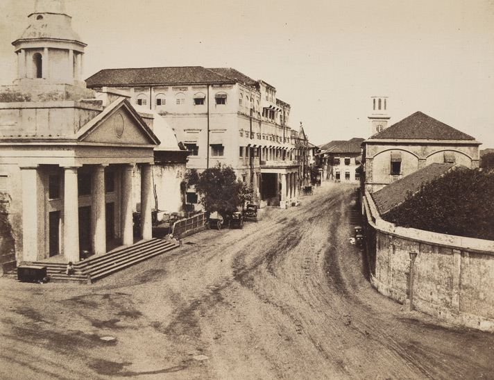 |
| Bombay's first ice house(ice storage house where ice unloaded from ship was stored) next to the harbour ;seen in the photo as a rounded white dome house;next to the church--1860's photo |
 | ||||||||||
|
"From the insides of this boat they were taking out great pieces of white stuff, which, in a little while, turned to water. Much split off, and fell about on the shore, and the rest they swiftly put into a house with thick walls. But a boatman, who laughed, took a piece no larger than a small dog, and threw it to me. I - of all people - swallowed without reflection, and that piece I swallowed as is our custom. Immediately I was afflicted with an excessive cold which, beginning in my crop, ran down to the extreme end of my toes, and deprived me even of speech, while the boatmen laughed at me. Never have I felt such cold. I danced in my grief and amazement till I could recover my breath, and then I danced and cried out against the falseness of this world; and the boatmen derided me till they fell down. The chief wonder of the matter, setting aside the marvellous coldness, was that there was nothing at all in my crop when I had finished my lamentings


 |
| VINTAGE ICE CRUSHER |
 |
| wooden ice cream freezer |

Developed for home use in 1848, the traditional crank ice-cream freezer employs a metal dasher inserted into a metal cylinder full of ice-cream base, which is placed in a bucket filled with a rock-saltand ice mixture (brine). The hand or motor-cranked dashers turn around in the ice-cream mixture as it freezes, preventing icecrystals from forming and ensuring a smooth, creamy final product.
|

 |
| HORSE PULLED ICE AND ICE CREAM CARTS c: 19th century |
 |
| (BOMBAY)MUMBAI 1910 PARTY |

Falooda
 | ||
| Kulfi: [India's answer to Gelato] |
 | |
| GolaA big ball of ice shavings twinkles like a lump of South African diamonds, kala khatta juice dripping off its sides. Fix it to your lips and slurp away in bliss. |
 |
| This image shows a water carrier pouring water from a leather bucket into the leather container slung over the back of a bullock;A Bheestie or Pukkalli [using a bullock - as in this image] is a domestic servant; Bheesties deliver as many potsful or skinsful as may be needed during the day, and are paid in proportion. They also serve in the regular army;In cavalry regiments a Pukkal Bheestie...is also on the establishment of every troop, in the proportion of one to twenty-five or thirty horses;[Watson and Kaye's 'The People of India', published in eight volumes from 1868 to1875] Many of the best houses in the Bazaar had deep wells of fairly good water within their tenements,but an abundant supply was available for those who had it not from the wells which had been dug outside the walls on the Esplanade,[NEWS OF THE GARRISON OF BOMBAY, 1845. as reported in 1887] READ ALSO:- the first dentist inside bombay fort etc news:- http://www.blogger.com/post-edit.g?blogID=2352176008720833167&postID=1499673596233307833 |
see also daily life and actvities inside bombay fort 1850's>>http://oldphotosbombay.blogspot.com/2011/02/bombay-fort-mapsphotospaintingsnews1600.html
 |
FORT BOMBAY WITH FORT WALLS 1850 |
PHOTO BELOW SHOWS:-
THE ORIGINAL CHURCH GATE OF BOMBAY FORT;
 |
| NAMED CHURCH GATE ; BECAUSE THE GATE WAS NEAR ST.THOMAS CHURCH WHICH CAN BE SEEN IN THE BACK. LATER CHURCH GATE RAILWAY STATION GOT THIS SAME NAME ;AS IT WAS BUILT NEAR THIS FORT GATE.THE FORT WAS BUILT AGAINST ENEMIES;SUCH AS PORTUGUESE AND SIDDI SHIPS THE GATE HAD A BRIDGE BUILT, OVER A MOAT, FILLED WITH WATER ;TO PREVENT ENEMY SOLDIERS;CAN BE SEEN IN THIS PHOTO |
http://www.iceharvestingusa.com/crystalblocks1.html
when the natives on Bombay first saw the ice being unloaded from ice barges:-
when the natives on Bombay first saw the ice being unloaded from ice barges:-
"From the insides of this boat they were taking out great pieces of white stuff, which, in a little while, turned to water. Much split off, and fell about on the shore, and the rest they swiftly put into a house with thick walls. But a boatman, who laughed, took a piece no larger than a small dog, and threw it to me. I - of all people - swallowed without reflection, and that piece I swallowed as is our custom. Immediately I was afflicted with an excessive cold which, beginning in my crop, ran down to the extreme end of my toes, and deprived me even of speech, while the boatmen laughed at me. Never have I felt such cold. I danced in my grief and amazement till I could recover my breath, and then I danced and cried out against the falseness of this world; and the boatmen derided me till they fell down. The chief wonder of the matter, setting aside the marvelous coldness, was that there was nothing at all in my crop when I had finished my lamenting s."
 |
| THE LONG LONG (HOT ) DAY IN AN ENGLISH MAN'S LIFE IN INDIA |
 |
| BOMBAY 1880'S BEFORE DISCOVERY OF AUTO MOBILES-(CARS) SHOWS HORSE (PULLED)TRAMS AND HORSE CARRIAGES AT FLORA FOUNTAIN.. IT SEEMS THE ROADS ARE SPRINKLED WITH WATER ,ON THE LEFT SIDE ,TO PREVENT DUST CLOUDS FROM ROAD;USING BULLOCK CARTS AS SEEN IN PHOTO HORSE DRAWN TRAMS;HORSE CARRIAGES,BULLOCK CARTS ALSO SEEN |

 |
| A horse-drawn tram on colaba causeway. The offices and stables of the Tramway Company is beside the Wesley Church, with the original steeple. A bus depot and the Electric House building replaced the Tramway Company office |
 |
 |
| FOOT PEDAL FAN[BEFORE ELECTRIC FANS WERE DISCOVERED} |
 |
| BOMBAY STREET SCENE 1900'S |
 http://oldphotosbombay.blogspot.com/2010_07_06_archive.html |
-BOMBAY-FLORA FOUNTAIN;SHOWING HORSE CARRIAGEcollotype by Clifton & Co., c.1900; * overview of theTAXI |
 |
| TOWN HALL 1850'S PHOTO |
 |
| PHOTO OF TOWN HALL BOMBAY |
 |
| PHOTO OF V.T.(VICTORIA TERMINUS RAILWAY STATION) NOW NAMED C.S.T (CHATRAPATI SHIVAJI TERMINUS)STATION;NO CARS -ONLY HORSE POWERED TRAMS;CARRIAGES;BULLOCK CARTS.C: 1880 |
Bombay showing the fort," from 'History of the Indian Mutiny', 1858*
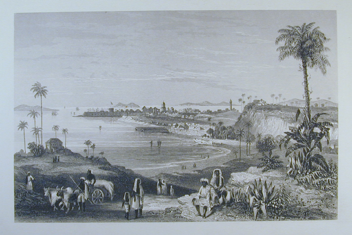
*"The Hon. East India Company's fleet of transports and war-steamers in Bombay Harbour, previous to their departure for the Persian Gulf," Illustrated London News, 1857*
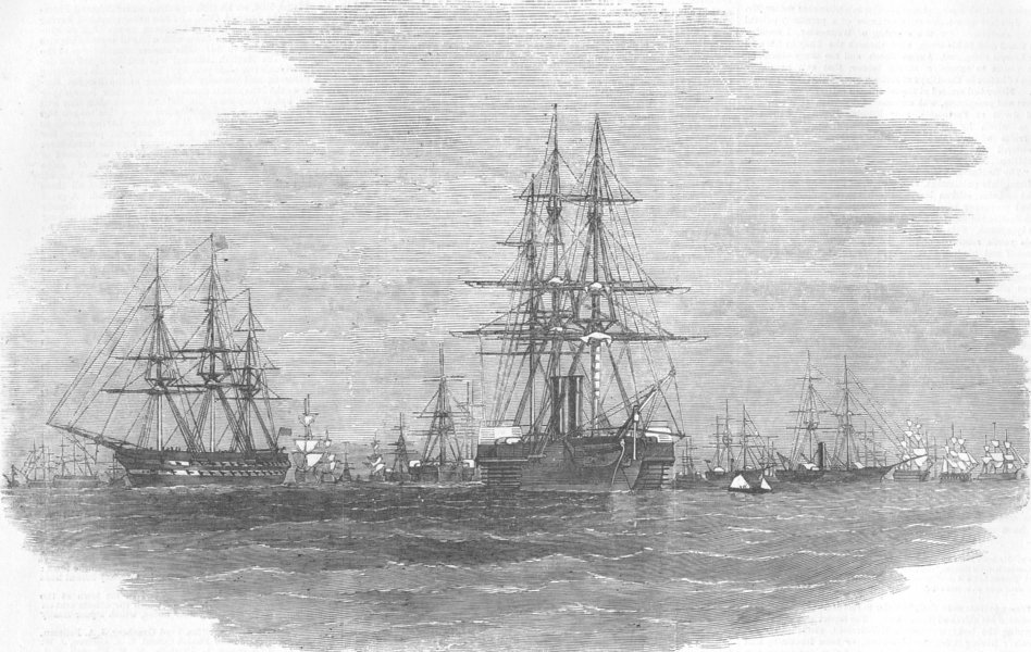
*"Landing at the Dockyard, Bander, of the remains of Lord Frederick Fitzclarence," Illustrated London News, 1855*

*"Native entertainment to European troops at Bombay," from the Illustrated London News, 1858*
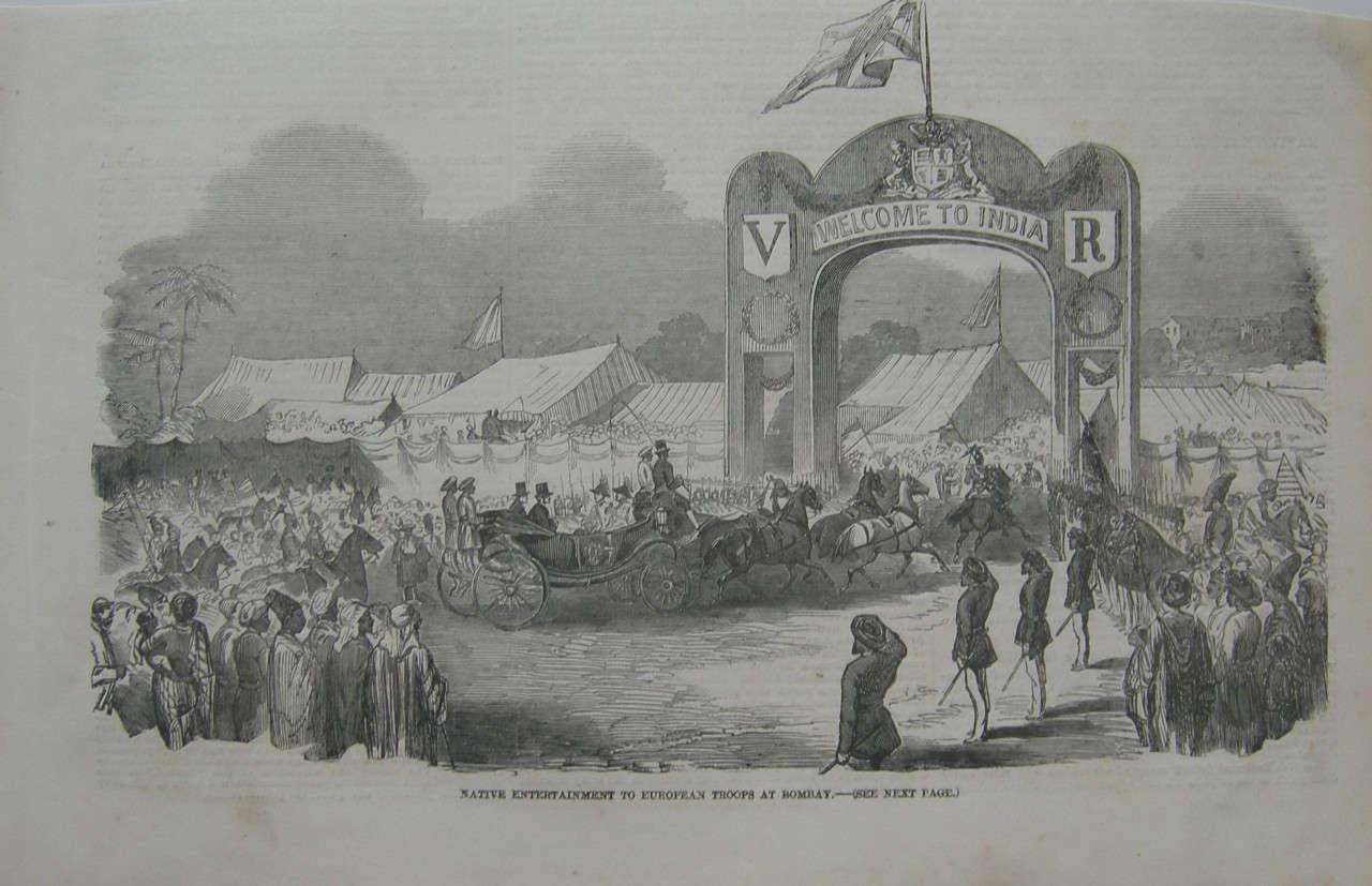
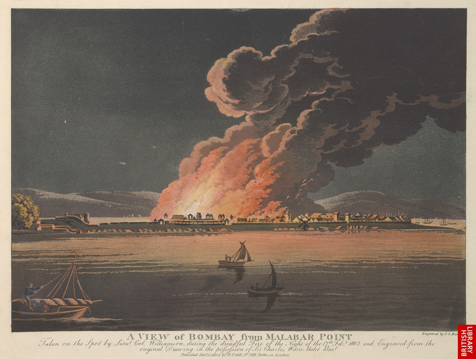
 |
| ANDHERI RAILWAY STATION C: 1870'SAND FOX HUNT BY ENGLISH MEN AROUND THE RAILWAY STATION[ A DESOLATE RAILWAY STATION BUILDING CAN BE SEEN IN THE MIDDLE OF WILDERNESS |
BOMBAY - CHURCH GATE RAILWAY STATION--1910's
BELOW :- PHOTO OF BANDRA -1850'S FOX HUNT

![[flora+fountain.jpg]](http://2.bp.blogspot.com/_iZMWbgTP0b4/SZ23u9AbXUI/AAAAAAAABUw/xWi8AEZJdq0/s640-rw/flora%2Bfountain.jpg)
Sindh Police in 1857
fashions;drinks;cigars,road rules etc of life in Bombay fort:-
http://www.blogger.com/publish-confirmation.g?blogID=2352176008720833167&postID=3700163255675270539×tamp=1297964796537&javascriptEnabled=true
http://www.blogger.com/publish-confirmation.g?blogID=2352176008720833167&postID=3700163255675270539×tamp=1297964796537&javascriptEnabled=true
HORSE CARRIAGES WAITING IN FRONT OF TAJ MAHAL HOTEL BOMBAY

BOMBAY CLUB1880'S

BELOW -WATSON [LUXURY ]HOTEL BOMBAY
ADELPHI HOTEL BOMBAY

BELOW PHOTO 1880'S-METRO THEATER AREA? CARS YET TO BE BORN!

ONLY HORSE CARRIAGES AND TRAMS
 |
| DOMED ICE HOUSE SEEN BETWEEN COURT AND CHURCH |
BELOW BOMBAY VICTORIA MEMORIAL RAILWAY STATION (NOW C.S.T. STATION)-B.C. [MEANS BEFORE CARS-1890'S ]

"Embarking elephants at Bombay for the Abyssinian expedition," from the Illustrated London News, 1868: very large scans of the *left half* and the *right half* of the engravin
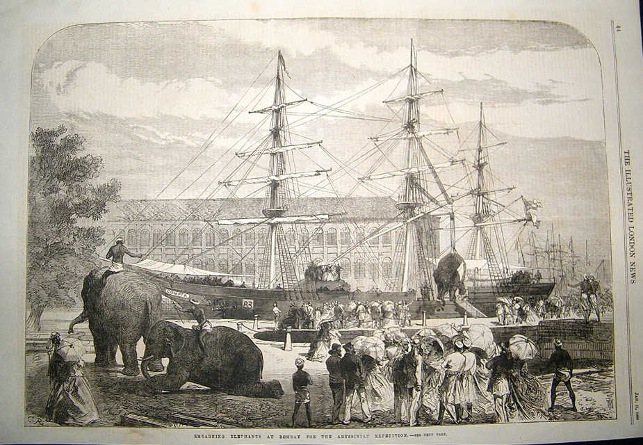
BELOW:-"KALA GHODA"STATUE;SEEN STANDING IN FRONT OF SASSOON LIBRARY AND Elphinstone College
{Kala Ghoda (Marathi: काळा घोडा) is a precinct or district in South Mumbai, India.
The name means Black Horse, a reference to a black stone statue of King Edward VII (as the then Prince of Wales) mounted on a horse it was actually build by the famous Jewish businessman and the greatest person who contributed a lot to the city of mumbai Sir David Sassoon who owned Most of the property of this area later also a Library and a lane named after him . Although this statue was removed in 1965 to storehouses of the Bhau Daji Lad Museum (formerly the Victoria & Albert Museum (Mumbai)) in Byculla, Central Mumbai, the name persists. The statue is now in the Jijamata Udyan in Byculla.}
"The Plague in Bombay: House to House Visitation,BY DOCTOR" from the Illustrated London News, 1898 (with modern hand coloring)
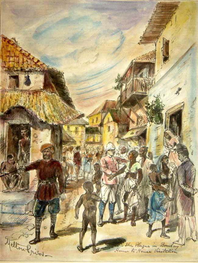
BELOW -STANDING IN MIDDLE OF ROAD IS THE BOMBAY POLICE MAN

CARS CAME TO INDIA IN 1898.THIS CAR NUMBER PLATE-REG:NO: 36-[-MAY BE THE 36TH CAR IN INDIA ]

 |
| SARDAR MIR ALI BAHDUR THE FIRST DETECTIVE OF POLICE OF BOMBAY IN 19TH CETURY |
'GATE WAY OF INDIA' BUILT HERE LATER; ALSO (PHOTO BELOW)
B
http://oldphotosbombay.blogspot.com/2011/02/old-postcards-of-bombay-mumbai.html
OFFICER SITS ON HAND PULLED RICKSHAW;
Rickshaw pullers playing cards 19 th century
A 1905 Humber car , photographed in Bombay-(ONE OF THE FIRST CARS IN BOMBAY)

FIRST FLEET OF TAXI CARS IN BOMBAY 1910;THE PASSENGER SAT IN THE COVERED CABIN WHILE THE TAXI DRIVER SAT IN THE OPEN FRONT ;JUST SAME ARRANGEMENT AS A HORSE CARRIAGE

TAXIS IN NEW YORK 1914-SIMILAR 20 CARS WERE IMPORTED FOR USE AS TAXI IN INDIA ;MAINLY FOR CALCUTTA,BOMBAY

. Jinnah's friend here is Pestonjee H J Rustomjee and the child is Homi Rustomjee.
DE DION BUTON CAR-1912-cars mostly handle start;self starting cars were made from 1912 onwards
THE MAN STARTING HIS CAR ; (BY CRANKING THE STARTING HANDLE WAS THE ONLY WAY ,BEFORE SELF STARTER WAS DISCOVERED)
CARS 1920 CALCUTTA
MAHATMA GANDHI ;NEAR CAR 1930'S
1920 -30 TAXI CARS ;NO CARS WERE MADE IN INDIA THOSE DAYS .SO ALL CARS WERE IMPORTED FROM AMERICA BRITAIN FRANCE OR GERMANY [.JAPANESE CARS BECAME POPULAR AFTER 1960]
CAR 1920-CROSSLEY
below :- flora fountain 1920's

cars on the road in india- THERE WAS NO 'A' OR 'B' OR 'C' JUST THE NUMBER FOR THE CAR--SEE BELOW THE CAR REGISTRATION NO: JUST '26903'.THIS WAS WHEN NUMBER OF CARS WERE VERY FEW-PHOTO OF CALCUTTA 1930'S
 |
| ENGLISH SOLDIER'S MESS IN COLONIAL INDIA (BEFORE ELECTRICLIGHT CAME),WITH GAS LIGHT AND OVERHEAD HAND OPERATED PUNKAH(FAN) |
 |
| The long white strips over the pews are hand-operated punkahs (fans)!IN THE ENGLISH CHURCH |
Bombay Electric Supply & Tramways Company Limited was a sole provider of electric supply, electric tram service and buses in the Mumbaicity from 1905 to till 1947 when it was municipalised to form the Bombay Electric Supply and Transport Undertaking. [BELOW PHOTO OF B.E.S.T.BUS 1920'S;AND B.E.S.T.'S SINGLE DECKER AND DOUBLE DECKER TRAMS,]
private taxi van 1930's [SEE THE BOMBAY REGISTRATION NO: B.M.B.210]
AND BUS1930'S
MARRIAGE TAXIS[OPEN HOOD CARS];HIRED ALONG WITH BAND WAS COMMON
One of the earliest emu trainsets (4-car ) speeding over the Sandhurst Road flyover
http://oldphotosbombay.blogspot.com/2011/02/travel-by-ship-before-1960-bombay-to.htmlhttp://oldphotosbombay.blogspot.com/2011/02/travel-by-ship-before-1960-bombay-to.html
1940'S TAXI CARS
MAHATMA GANDHI ENTERING CAR -1940'S PHOTO
1940 TAXIS -CHEVEROLETCARS
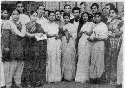
( front row) Zohra Jan, Rajkumari, Amirbai Karnatki, Hamida Banu, Geeta Roy (later Geeta Dutt), Lata Mangeshkar, Meena Kapoor, (and standing behind) Sailesh Mukherjee, Talat Mahmood, Dilip Dholakia, Mohd. Rafi, Shiv Dayal Batish, G.M. Durrani, Kishore Ganguli (later Kishore Kumar), and Mukesh.
RATAN (1944)Stars:
Swaran Lata, Karan Dewan and Amir Banu
Soundtracks
"Ankhiyan Milake"Sung by Zohrabai Ambalawali
Music composed by Naushad
Lyrics by D.N. Madhok
1942 FORD CARS AND TRUCK
1940'S FORD TRUCK
1940-50 BOMBAY MARINE DRIVE


1942 FORD JEEP AS TAXIS WERE USED FOR HILLY TERRAIN
1944 FORD VAN WITH WOODEN BODY
1944 FORD MILITARY TRUCK WERE CONVERTED TO CIVIL LORRIES AND WERE USED AS BREAKDOWN TRUCK IN BOMBAY TILL 2000
1945 FORD WAS VREY POPULAR AS PRIVATE CAR AND AS TAXIS TILL 1980
BELOW (THE POPULAR) FORD CAR 1948 -USED FOR WEDDINGS AND AS TAXI
AND 1946 FORD VAN WITH WOODEN BODY
1950'S HILLMAN TAXI OF BOMBAY[MADE IN ENGLAND]
TAXI DRIVER (1954) HINDI MOVIE[ACTORS DEV ANAND AND KALPANA KARTIK-LATER THEY GOT MARRIED IN REAL LIFE]
BOMBAY TAXI BMT 1800-C.1950'S
PONTIAC CAR[MADE IN AMERICA] AS TAXI
HILLMAN MINX MADE IN BRITAIN WAS VERY POPULAR AS TAXI IN BOMBAY TILL 1970
AUSTIN CAR AS TAXI-1950'S NEAR A HOTEL
AUSTIN A40 TAXI CAR [MADE IN ENGLAND]
THE FIRST CAR TO BE CONVERTED INTO A INDIAN CAR--MORRIS MINOR ENGLAND WAS MADE INTO HINUSTAN CAR 1950-SEEN BELOW
MORRIS MINOR(LATER RENAMED BAY HINDUSTAN) TAXI CAR C.1950'S
BABY HINDUSTAN CAR-FIRST CAR TO BE MADE IN INDIA [COPIED FROM MORRIS MINOR ENGLAND]C.1950
ANOTHER CAR WHICH WAS CONVERTED INTO AN INDIAN CAR-MORRIS OXFORD INTO HINDUSTAN LAND MASTER AND LATER INTO AMBASSADOR-SEE BELOW
1956 FIAT MILLICENTO ALSO KNOWN AS DUKKER FIAT -USED AS TAXI IN 1960'S
BMC (BOMBAY)7921
LATER MODEL FIAT -KNOWN AS PREMIER PADMINI BELOW
1960 Tata Mercedez Benz trucks in India
STANDARD CARS MADE IN MADRAS (CHENNAI) CALLED HERALD / TRIUMPH; A FEW USED AS TAXIS IN SOUTH INDIA
ENGLISH MAN'S LIFE IN INDIA 1850'S
CLICK AND READ THIS BOOK>>>>> >> "Curry & rice," on forty plates;

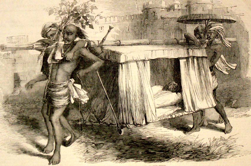
No comments:
Post a Comment